Click here for other railways.
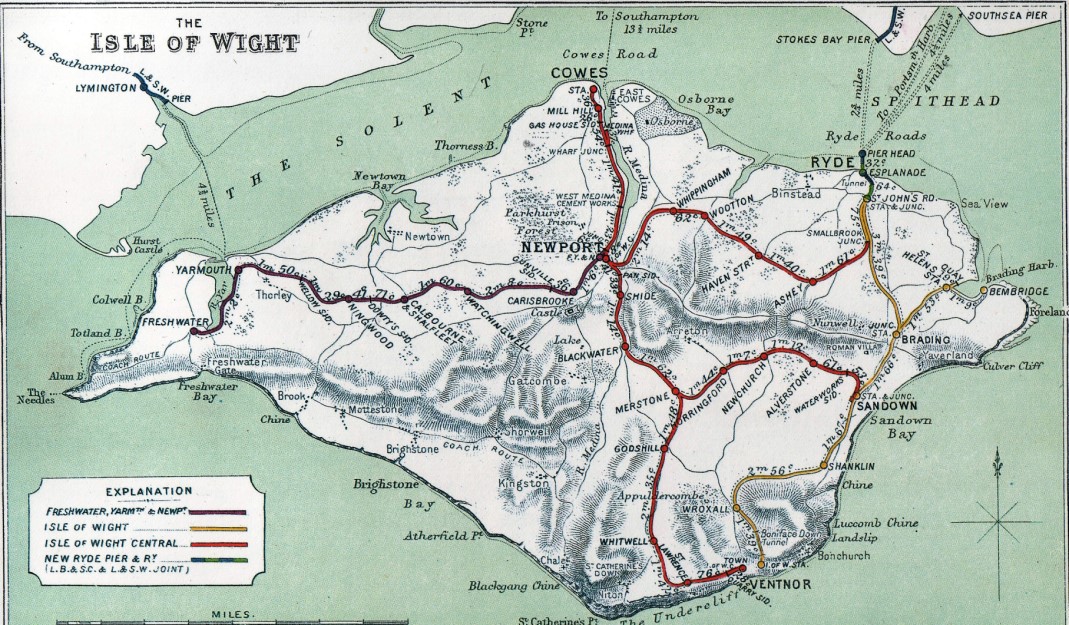
Isle of Wight Railways
Isle of Wight Railway Network Map
The first railway to be built on the island ran for a distance of 2,500 yards. It was opened in 1833 on the Nash Estate near Yarmouth. Its usage is presumed to have been for transporting brickmaking materials to and from a jetty on the Solent, and it is not thought to have used mechanical traction.
The main routes were opened by several companies between 1862 and 1901 and modernised after The Grouping in the 1920s. Most of them were permanently closed between 1952 and 1966, whilst the Island Line was temporarily closed in 1966 and rebuilt for electric train services, introduced in 1967. Replacement trains were introduced in 1990, and a major renewal is due in 2021. A section has reopened as a heritage line known as the Isle of Wight Steam Railway (IWSR).
The Isle of Wight Railway (IWR) company built its initial line from Ryde to Shanklin, opening in 1864. Also in 1864, horse-drawn trams began running along Ryde Pier, connecting ferry services to the town. The IWR opened an extension of its main line to reach Ventnor in 1866. In 1871, the Ryde tramway was extended to meet the railway line at Ryde St John's Road.
The Ryde & Newport Railway opened in December 1875, with operations controlled by the Cowes & Newport company.
In 1875, the Isle of Wight (Newport Junction) Railway opened the main part of its 10-mile Sandown to Newport line. In February 1875, the line was opened between Shide, a suburb of Newport, and the IWR station at Sandown. Eight months later the line was extended a further half-mile to reach Pan Lane. However, the final half-mile from there to Newport station did not open until 1879. Four years of poor connections in Newport meant not enough passengers or freight had been attracted to the line, and the company passed into receivership in 1880. At this point, it was bought by the Cowes & Newport/Ryde & Newport company, who were legally renamed as the Isle of Wight Central Railway (IWCR).
In 1877 the London, Brighton and South Coast Railway and London and South Western Railway were granted an Act of Parliament to extend Ryde Pier, building a railway line from the pier head to St John's Road. This was completed in 1880 and opened in 1880 by Portsmouth and Ryde Joint Railway (P&RJR). At this point the Ryde tramway was shortened to simply run along the pier.
In 1882, the IWR opened a branch line from Brading to Bembridge, serving a large natural harbour between Bembridge and St Helen's stations. A short-lived train ferry from Bembridge Harbour to the Hayling Island branch also started at this point.
In 1889, the Freshwater, Yarmouth and Newport Railway (FYN) opened its 12-mile line from Newport to Freshwater, the only line to run west of Newport. Services on its line were operated by the IWCR under a mutual agreement. However, in 1913 this agreement deteriorated to the point that the FYN was forced to purchase its own locomotives and rolling stock.
The network was completed by the Newport, Godshill and St Lawrence Railway's Ventnor West branch line from Merstone, on the Sandown-Newport line, to St Lawrence on the south coast. This was opened in 1897, and extended to Ventnor West in June 1900. This line, the last to be built on the island, was taken over by the Isle of Wight Central (IWCR).
A fixed railway link to the mainland was authorised by Parliament in 1903. The South West and Isle of Wight Junction Railway was a joint project between the London & South Western Railway and the FYN. The excavation of a two and a half-mile long tunnel was approved in 1903, 1904 and 1909. However, the tunnel project was abandoned due to the outbreak of the First World War in 1914.
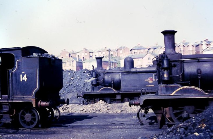
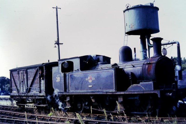
After the Railways Act 1921 came into force from January 1923, the Southern Railway took over all lines on the island. The company set about significant investment in the island's rail services, primarily through replacing old locomotives and carriages. Twenty-three O2 Class locomotives were transferred to the island from the former London and South Western Railway's suburban services, and many coaches were brought from the former London, Chatham and Dover Railway and London, Brighton and South Coast Railway. The locomotives were given numbers under an unusual system where each number was individual only on the island. Each locomotive officially carried its number with a W-prefix to indicate this, and was given a nameplate relating to somewhere on the island (e.g. W 24�Calbourne). A new named train called The Tourist was set up, running from Ventnor to Freshwater via Sandown, Merstone and Newport. It was the only named train on the island, and travelled on lines from all the former Isle of Wight railway companies.
In 1948, the railways of the United Kingdom, including those on the island, were nationalised as British Railways. Under separate modernisation schemes, the FYN line, Ventnor West line, Bembridge branch and Sandown to Newport line had closed by the end of 1956. In 1966, under the recommendations of the Beeching Report, services were withdrawn on the Ryde to Newport and Cowes lines, and between Shanklin and Ventnor.
The line between Ryde and Shanklin was also earmarked for closure by Beeching, but the TUCC stated that this would cause severe hardship and the Minister of Transport refused consent, so management decided to authorise electrification instead. This remaining Ryde-Shanklin line was electrified using the third rail system and Class 485 and Class 486 trains, which had previously worked on the London Underground. The new electric service began in March 1967.
Click here
and here for Locomotives and Rolling Stock.Click here for Videos.
Isle of Wight Railway (IWR) - Ryde to Ventnor
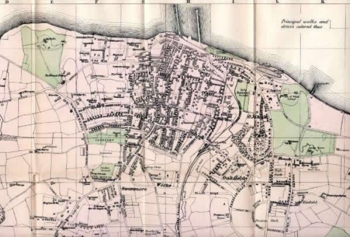
Map of both the Ryde Piers showing tramway and connection to St. Johns Road railway station 1906.
Ryde Pier
Opened in 1814. Originally 576 yards long and by 1833 extensions took the overall length to 745 yards.
The pier is Grade II listed and the world's oldest seaside pleasure pier. Before the pier was built, passengers had the uncomfortable experience of coming ashore on the back of a porter and then, depending on the state of the tide, having to walk as far as half a mile across wet sand before reaching the town.
The first regular ferry crossing from Ryde Pier to Portsmouth started with the Britannia in 1817. In 1827 the pier head was expanded to allow for two steamers to berth at the same time, and a further set of small landing stages were built too. When trains ran to Gosport in 1842 a Gosport to Ryde service was launched. Later, from the pier you could regularly travel to Portsmouth or Southampton, or take excursions to places such as Lymington, Bournemouth and Brighton.
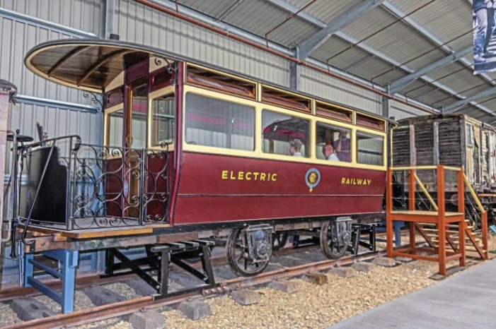
In 1864 a second pier next to the pedestrian pier was built for a tramway where horse-drawn trams took passengers from the pier head to the esplanade. Before construction of the railway pier in 1880, the tramway continued to Ryde railway station at St John's Road. The next means of power, after horses, deployed to operate the trams was steam traction, having little success and lasting only for a short time. Following its failure electric power was deployed in 1866, meaning new trams were powered by electric traction and a third rail feed. Thus Ryde had the distinction of being only the second electric railway in England at the time - behind only Brighton. The electric tram was replaced by diesel vehicles in 1927. The tramway closed in 1969 and the structure was partially dismantled. This has left the disused and decaying tramway pier between the railway and promenade piers.
In 1880 a third pier was opened alongside the first two providing a direct steam railway link to the pier head.
In 1895 a concert pavilion was constructed at the pier head and was used until the 1950s. The pier head was remodelled in the 1930s using concrete.
Ryde Pier Horse-drawn Trams late 1800s.
Ryde Pier Electric Tram early 1900s.
Ryde Pier 1905.
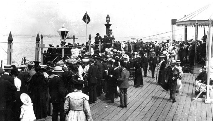
Ryde Pier on a busy day in the 1950s.
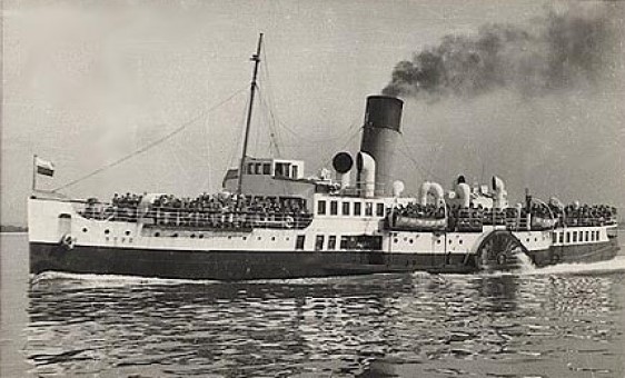
The Paddle Steamer "Ryde"
The Southern Railway ordered PS Ryde in 1936 and it entered service in 1937 after being built by William Denny & Bros at Dumbarton, which built many SR ships. It was built for working across the Solent and carrying up to 1050 passengers, which it did until 1969. In its last few years it was only used in the peak summer months as a relief vessel.
After a week of sailing on charters on the Thames from Tower Bridge in September 1969, the steamer moved to a berth on the Isle of Wight, midway between Newport and Cowes and was used variously as a marina clubhouse and then a nightclub. The vessel was fire damaged in 1977, but was repaired and was used as a nightclub again.
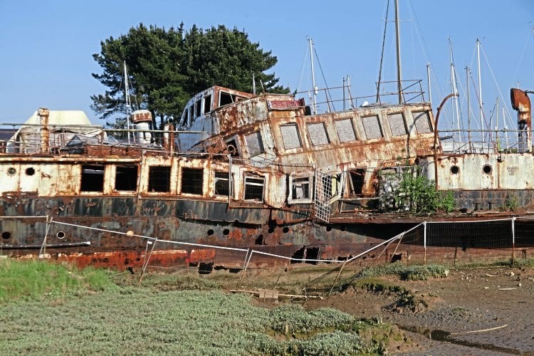
Despite falling into disrepair in the last 20 years or more, the ship is listed on certificate No. 61 on the National Historic Ships Register, because its World War Two activities initially saw it being used as a minesweeper and, from 1942, as an anti-aircraft vessel taking part in the Normandy landings. It re-entered passenger service a year later in 1945.
PS Ryde is now moored on a tidal mudflat at Island Harbour on the Isle of Wight, with its bridge having collapsed. In 2018 a plan was being prepared for its rescue.
The Paddle Steamer "Ryde" 1930s.
The Paddle Steamer "Ryde" Today.
Ryde Victoria Pier
Opened in 1864.
For a few decades, Ryde had a second pier, the Victoria, a few hundred yards to the east. It was promoted by the Stokes Bay Pier and Railway Company to provide a landing for a rival ferry service from Gosport. It opened in 1864 as the main pier was getting its tramway. Being somewhat shorter than Ryde Pier, it could not be used at all points of the tide, and so offered little competition to the main Ryde to Portsmouth ferry services. When the Stokes Bay company was acquired by the London & South Western Railway in 1875, the ferry service ceased, and Victoria Pier became a pleasure pier only, with public hot and cold ozone baths at the head and a swimming platform at the dry end. By 1900, use of the bathing facilities was declining, and Victoria Pier gradually became derelict. The austerity of the First World War led to it being considered redundant and a hazard, and in 1916, its demolition was authorised by Act of Parliament. By the 1920s it had gone. Until the construction of the marina in the 1980s, the outline of the shore-end abutment could be made out in the sea wall near Ryde Pavilion, and at low spring tide the stumps of the piles could be seen in the sand offshore.Ryde Victoria Pier (on right) early 1900s.
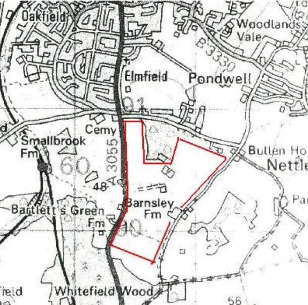
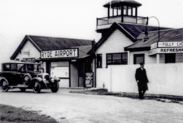
Ryde Airport:
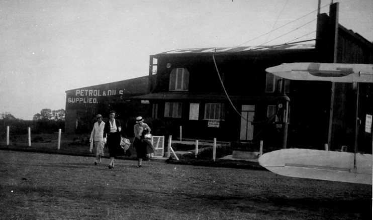
Opened on 27th June 1932 on land near Barnsley Farm (see map abelow) by Wight Aviation Ltd (later renamed Isle of Wight Aviation Ltd). The official name of the new aerodrome was "Isle of Wight Air Port". Portsmouth, Southsea and Isle of Wight Aviation operated services from Ryde to Portsmouth, Shoreham and Shanklin (Apse). In addition services were later operated by Railway Air Services and Channel Air Ferries.
The airfield was closed and the landing area obstructed in 1939 for the duration of the war. Due to government restrictions on operation of privately owned airline services(the objective was that the state owned airlines would monopolise all scheduled services), Ryde remained unused for some time after the war. The Ryde town council had ambitious plans for postwar expansion of the airfield but these were evidently abandoned when it became apparent that hoped for airline services were not going to happen. However it was officially reopened on 6th May 1950 for both private flying and charter operations. The airport had a short runway, so restricting the types of aircraft that could use it, and often suffered bad crosswinds which could make landing and take-off rather tricky. Pilots therefore had to carefully balance the craft before attempting take-off in rough weather. The airfield was not financially viable and closed again after a short time.
Ryde Airport map.
Ryde Airport Terminal 1930s.
Ryde Airport adverts 1934.
>
>
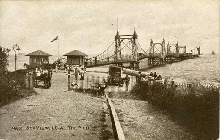
Seaview Pier
Opened in 1881.
The Seaview Pier Company was formed on 20th December 1877 and work began in September 1879 to the design of Frank Caws. The unfinished pier officially opened on 7th June 1881. Disappointingly, steamer traffic did not significantly increase tourism to the area.
In 1889, a 50 foot extension and a new pier-head increased the length to 1050 feet. A larger pier-head was erected in 1901 and slot machines were added. Passenger services stopped during World War One, restarting in 1920.
The Navy took over the pier during World War II. By 1945, it was in poor condition and was sold, in November 1947, to Mr. Figgins for just �775. Restoration plans became demolition plans in 1948, a residents� meeting accepting that the town would not be able to finance the work.
In August 1948, the pier was bought by the Horwich brothers. It became the first pier to be �listed� under the Town & Country Planning Act. However, a series of storms between October 1950 and December 1951 left only the pier-head and around 100 foot of promenade deck intact. These were demolished in 1952.
Seaview Pier map early 1900s.
Seaview Pier early 1900s.
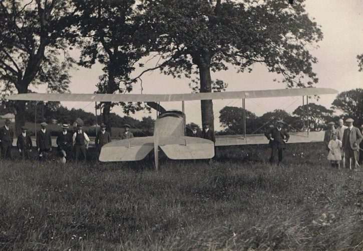
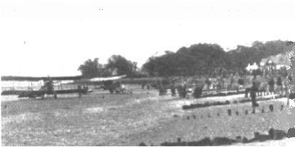
Seaview Airfield
On June 9th 1913 Harry Hawker and the Sopwith D1 Three Seater visited Seaview after a flight from Brooklands. The pilot was Harry Hawker who was at that time the chief pilot for the Sopwith Aviation Company.Sopwith D1 Three Seater visited Seaview 1913.
In May 1920 The Brompton Motor Company commenced using the sands between Seaview & Ryde as an aerodrome for joy riding flights.
Planes on beach Seaview 1920s.
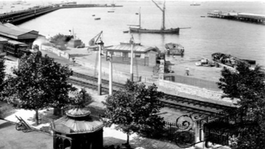
Ryde Pier Head Station
Situated at the end of the town's pier, it is adjacent to the terminal for the services connecting the island with Portsmouth on the UK mainland.
Opened in 1880 by Portsmouth and Ryde Joint Railway (P&RJR).
The P&RJR was a group of three railway lines in Southern England that were jointly owned and operated by the London and South Western Railway (LSWR) and London, Brighton and South Coast Railway (LBSCR). The jointly-owned line ran north from Ryde St John's Road. Under the direction of LBSCR Chief Engineer Frederick Banister, the construction of the extension included a new tunnel and a third Ryde Pier to enable the line to reach a new station at Ryde Pier Head, which provided a connection with the companies' ferry services.
The station originally consisted of three platforms in the form of a pair of islands; a fourth track was added later, opening in 1933. The station was rebuilt on electrification of the remaining line in 1967, and the new layout consisted of two tracks with three platform faces. One of these tracks is now out of use, so only one platform currently operates. This is the track which runs along the western side of the pier; a double track section commences immediately to the south of Ryde Esplanade railway station.
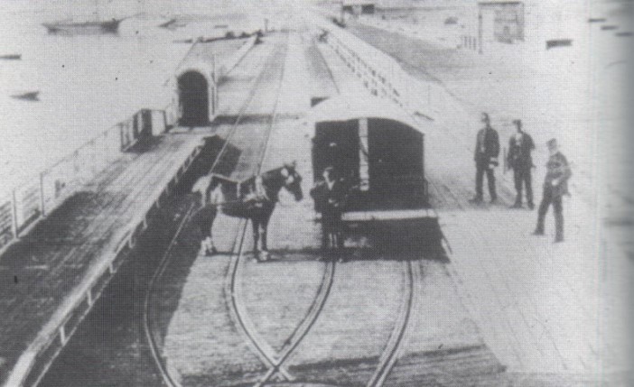
In addition to the railway there was a tramway which ran the length of Ryde Pier from 1864 until its closure in 1969. Originally in 1864 The Ryde Pier Company opened a standard gauge horseworked tramway. The Pier Company subsequently experimented with steam tram engines and steam tram cars, and, in 1886, they ultimately became pioneers in the use of electric traction. In 1927 the Siemens electric power system was abandoned in favour of petrol-engined rail-cars. In 1968 an inspection of the tramway pier and rolling stock resulted in the system being condemned, with closure following in 1969.Ryde Pier Head Station map mid 1900s.
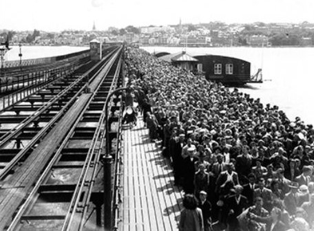
Ryde Pier Head Station - Railway and Tramcar 1965.
Ryde Pier Head Station 1965.
Ryde Pier Head Station 1928.
Seagull Ballroom Cafe at Ryde Pier Head 1952.
Ryde Esplanade Station
Opened 1880. Originally known as Pier Gate.
A station has existed on the site since 1864 when a horse-drawn tram service began operation along the new Ryde Pier.Ryde Esplanade Station map early 1900s.
Ryde Esplanade Station early 1900s.
Ryde St John's Road Station
Opened in 1864 as Ryde railway station, as it was the northern terminus of the Isle of Wight Railway at the time. Changed to Ryde St John's Road in 1880.
Rather than a railway, a tramway continued northwards to where the current Ryde Pier Head railway station stands; the railway was extended to Ryde Pier in 1880.
After the railways of the Isle of Wight had merged into one with the formation of the Southern Railway the locomotive servicing and repair facilities were centred on Ryde St John�s Road where the premises were either side of the station. On the west side of the station was a two road engine shed with two other roads alongside whilst on the east side were the C.M.E�s sidings consisting of a three road shed plus four other sidings, the first and fourth of which ran into another, smaller, shed alongside the main one.Ryde St John's Road Station map late 1800s.
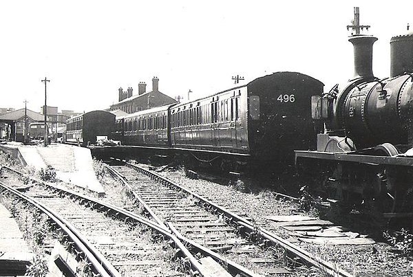
Ryde St John's Road Station 1949.
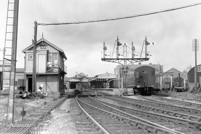
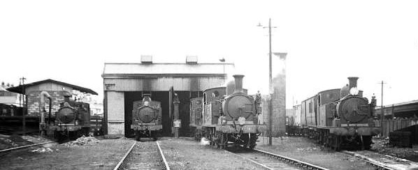
Ryde St John's Road Shed 1960s.
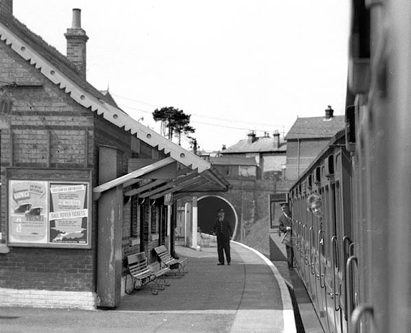
Smallbrook Junction Station (IWSR)
Opened in 1991 by British Rail.
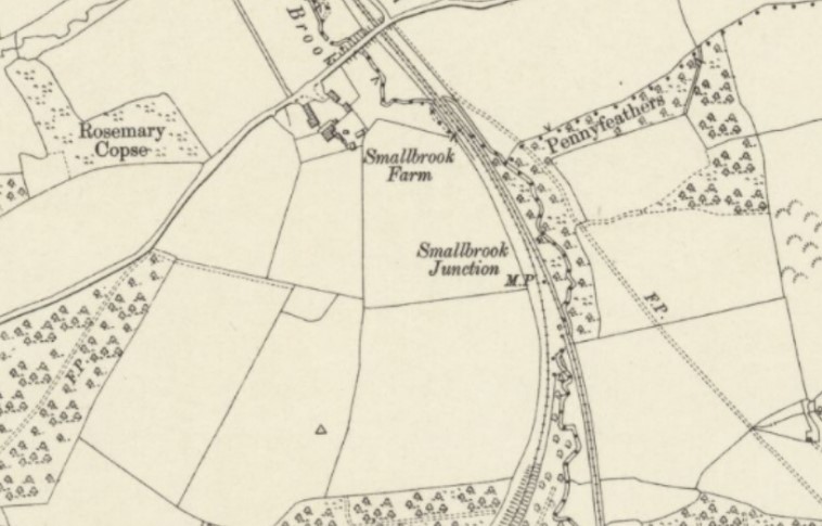
Opened when the Isle of Wight Steam Railway was extended to reach the Island Line, in order to provide a passenger interchange between the two. It is only served on days that both the Island Line and the Steam Railway are open, as there is no access either by path or by road. Prior to 1991 there was no station on this site, but it was still an important railway junction. "Smallbrook Junction" is the historic name, long predating the station. Between 1875 and 1926 there were two separate lines here, independently run by the Isle of Wight Central Railway and the Isle of Wight Railway. In 1926, following the island's rail network passing to the Southern Railway, a signal box and turnouts were installed at Smallbrook. From then until 1966, the line was the Junction between the Ryde Pier Head to Ventnor and Ryde Pier Head to Cowes Lines.Smallbrook Junction Station map.
Smallbrook Junction Station Today.
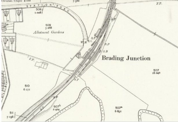
Brading Station
Opened in 1864 by the Isle of Wight Railway.
Originally on their initial Ryde-Shanklin line. In 1882 it became a junction station, when the Brading-Bembridge branch line opened as part of the Brading Haven reclamation scheme. The branch line closed to passengers in 1953 and completely in 1957.
Under Southern Railway ownership, the passing loop was extended southwards from Brading to Sandown in 1927, forming a second section of double track on the Island Line.
The signal box and main station building are Grade II listed, along with the station building on the east platform, the footbridge, and the station house. The restored signal box and station buildings are now home to a heritage centre, caf�, museum and a Tourist Information Point along with a bike hire shop.
Brading was one of the last stations on the British Rail network to retain gas lighting, with the fittings converted to mercury vapour usage in 1985. As of 2010 some of the fittings were still in use, now using compact fluorescent bulbs.Brading Station map early 1900s.
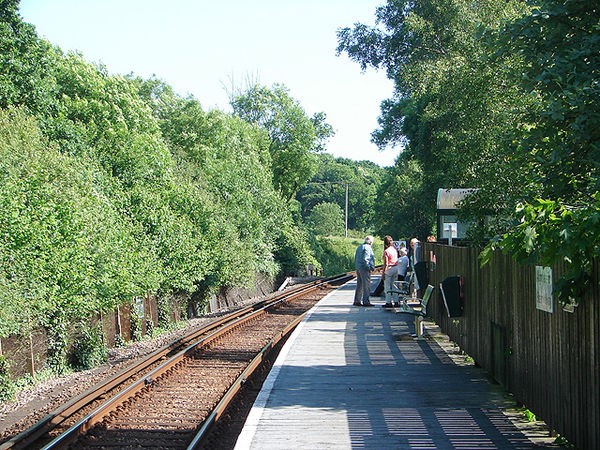
Brading Station.
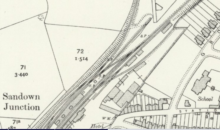
Sandown Station
Opened in 1864.
Extended between 1870 and 1871.
From the mid 19th until the mid 20th century it was a junction station, also served by trains to and from Horringford, Merstone, Newport and Cowes. These lines used to be run by separate companies, the Isle of Wight Railway (Ryde-Ventnor) and the Isle of Wight Central Railway (Newport-Sandown).Sandown Station map Early 1900s.
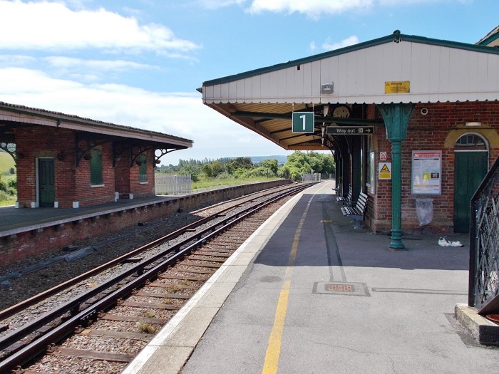
Sandown Station.
Sandown Station 1960s.
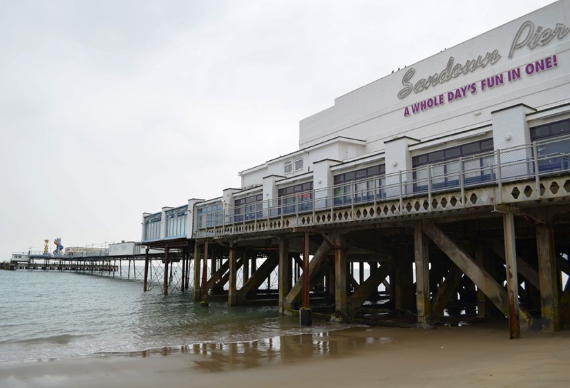
Sandown Pier
Opened in 1878.
Plans for the pier were drawn up in the 1860s and bill passed in Parliament in 1864. However, construction did not start until 1876. The first section of the pier measured 360 feet and it was opened on 29 May 1878.
Work to extend the pier to its full intended length were started in 1894. The new works were badly damaged in a storm in 1895 but reopened following modifications which lengthened it by 545 feet giving it a total length overall of 870 feet. A landing stage was provided to allow passengers to arrive and depart by steamer. A pavilion to accommodate 400 people was constructed on the head of the pier with an eliptical dome. In 1934 the pavilion at the shore end of the pier was added. In 1989 a fire broke out in the amusement arcade and spread into the theatre but the pier was reopened for the 1990 summer season.
Sandown Pier map mid 1900s.
Sandown Pier 1920s and today.
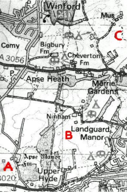
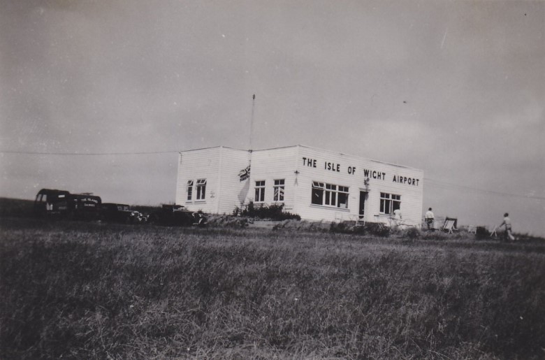
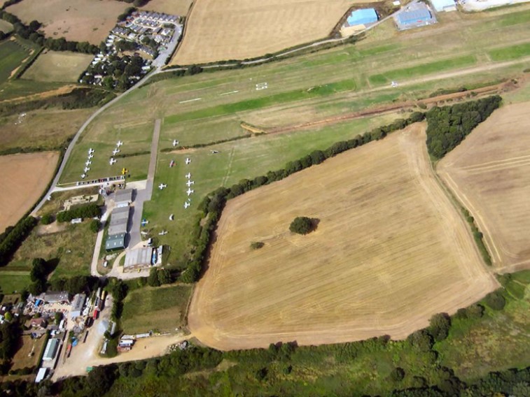
Sandown Airport:
Sandown airport has existed in 3 separate locations.
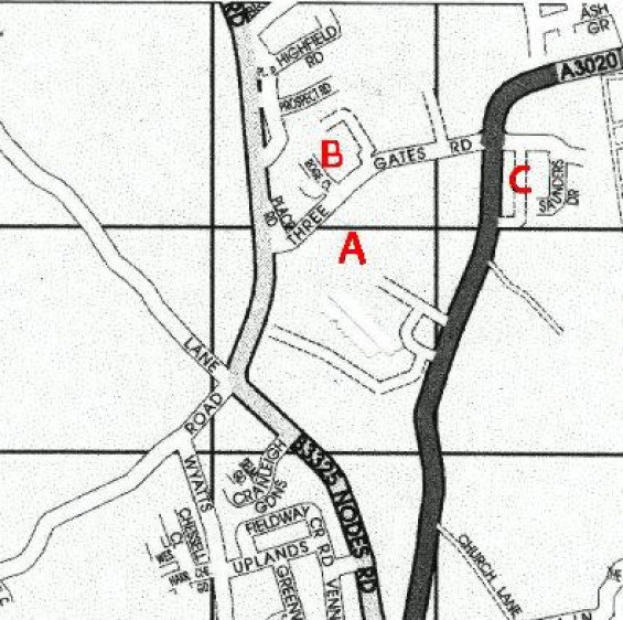
The first airfield (also known as Shanklin) "A" on the map below was at Apse Manor Farm. This grass field was used from 1929 until 1934, principally by the Isle of Wight Aero Club and also by Wight Aviation Ltd (later became PSIOWA - Portsmouth, Southsea and Isle of Wight Aviation Ltd).
During 1934, the landing ground was briefly located about a mile NE between Ninham and Landguard Manor ("B" on map). This lasted only a year.
Lea Farm Airport (as it was then known) opened at Easter 1935 and became the focus for airline services to the Island.The first operator was Spartan Airlines. Spartan were joined by Railway Air Services on the 25th June,and later by Portsmouth, Southsea and Isle of Wight Aviation and Channel Air Ferries. In addition the Isle of Wight Aero Club re-opened in 1936.
When WW2 started the airfield was closed and the landing areas obstructed.The airfield re-opened after the war as the Isle of Wight Airport, and services resumed, operated by various (often short-lived) airlines. From the 1st June 1963 services were operated by Derby Airways. Later renamed British Midland they continued until 1968. By the early 70s business was declining, and the field closed. In 1976 the airfield re-opened. The airfield has operated since as a general aviation field, however there are no longer any scheduled services.Sandown Airport map.
Sandown Airport Building mid 1900s.
Sandown Airport today.
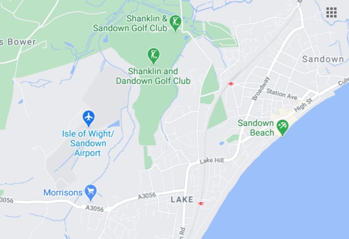
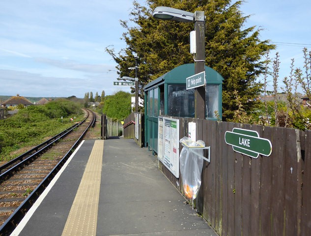
Lake Station
Opened in 1987.Lake Station map today.
Lake Station today.
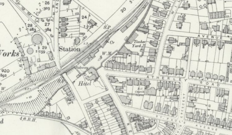
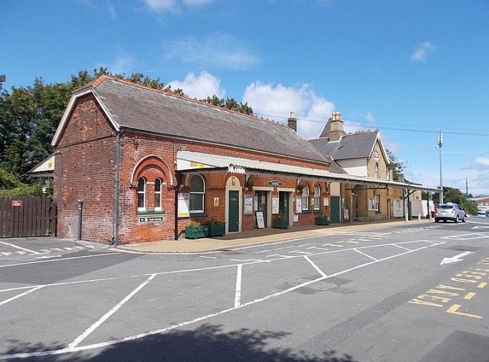
Shanklin Station
Opened in 1864.
The station buildings were extended in 1881 and is now Grade II listed.Shanklin Station map early 1900s.
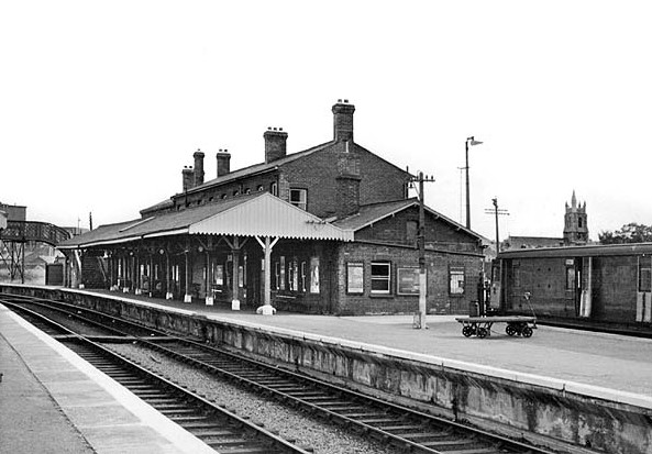
Shanklin Station 1950s.
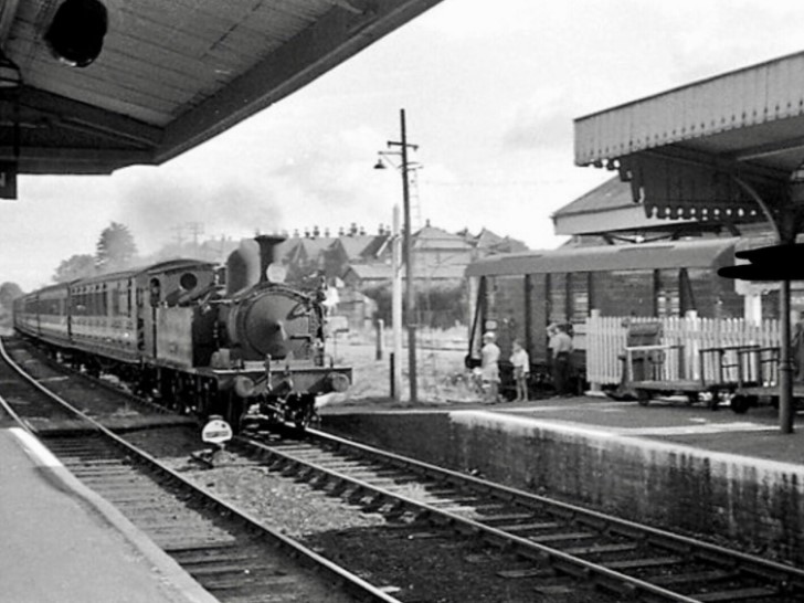
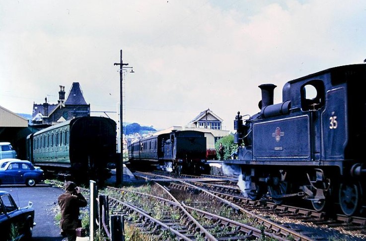
Shanklin Station 1960s.
Shanklin Station today.
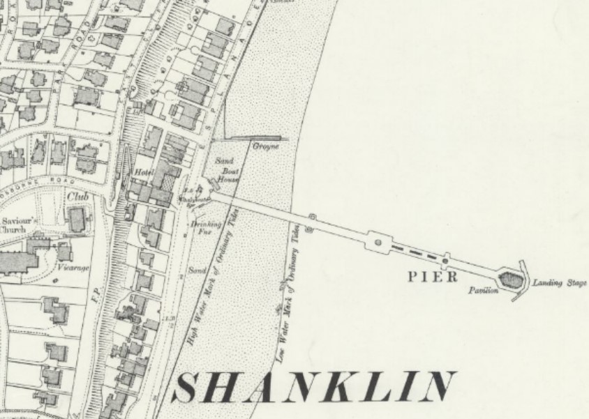
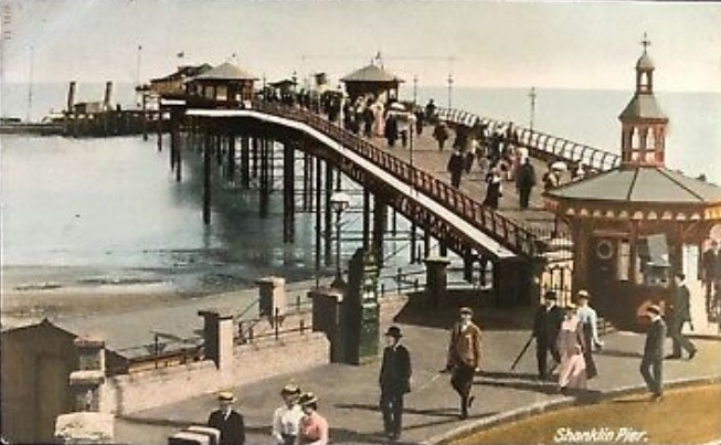
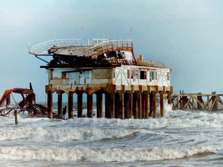
Shanklin Pier
Opened in 1890. Work on the pier began in 1888 being 1,200 foot long it also had to be high enough to accommodate the bathing machines which needed to pass underneath with ease. The entrance was adorned with two pagoda style toll booths and on the 18th August 1890 the steamer Flying Falcon was there to be the first craft to dock on the piers opening day. During 1893 a bad stand pavilion was erected and water polo was being played at the pier head. The pier did well up until the 1970's when frequent changes of ownership lead to its decline, despite feeble attempts to repair it, by the early 1980's it was in a very bad sate of repair. Thus when the storm of 1987 hit the Island it tore into it and ripped it apart with ease. There were various proposals put forward to try and rebuild, however nothing came of them and the pier was eventually demolished in 1993.Shanklin Pier map Early 1900s.
Shanklin Pier early 1900s.
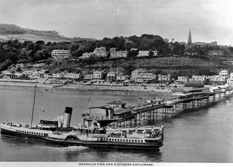
Shanklin Pier 1906.
Shanklin Pier 1987.
Shanklin Airport:
Shanklin Airport is marked "A" on the map below and was at Apse Manor Farm. This grass field was used from 1929 until 1934, principally by the Isle of Wight Aero Club and also by Wight Aviation Ltd (later became PSIOWA - Portsmouth, Southsea and Isle of Wight Aviation Ltd).
Sandown and Shanklin Flying Services was formed in early 1935 with the objective of buying Shanklin Flying Services business (including 2 aircraft) and operating from Sandown.Shanklin Airport map.
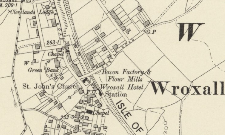
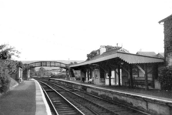
Wroxall Station
Opened in 1866. Closed in 1966.
As built Wroxall Station had a single platform on the up side of the line. In 1925 the Southern Railway increased the line capacity on the Ryde - Ventnor route. At Wroxall this included a new crossing loop and down side platform with a small waiting shelter. A single siding served a small goods yard on the other side of the Castle Road overbridge.Wroxall Station map early 1900s.
Wroxall Station 1965 and 1968.
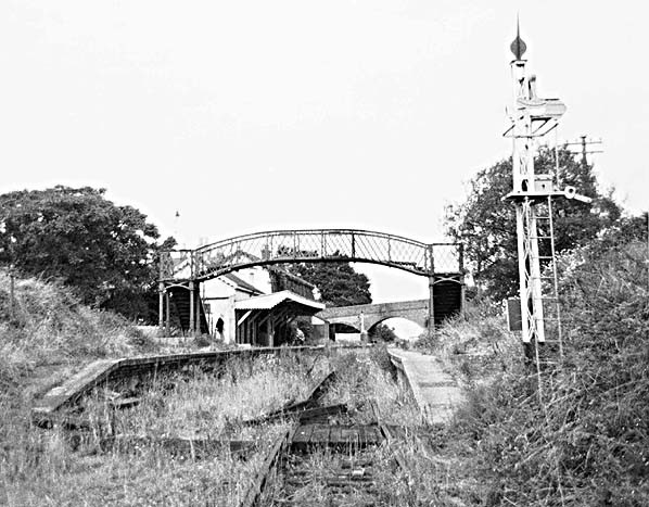
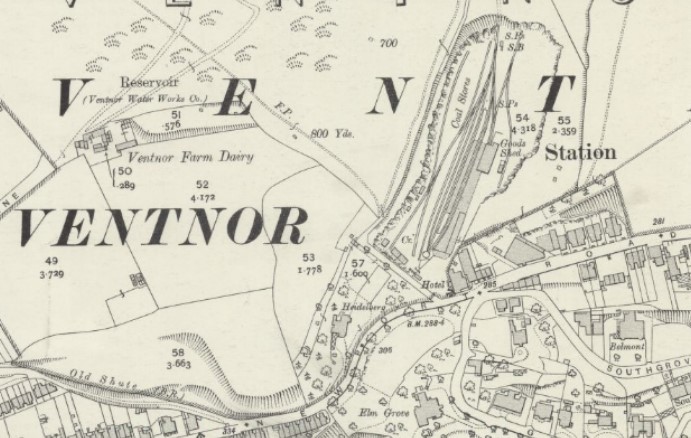
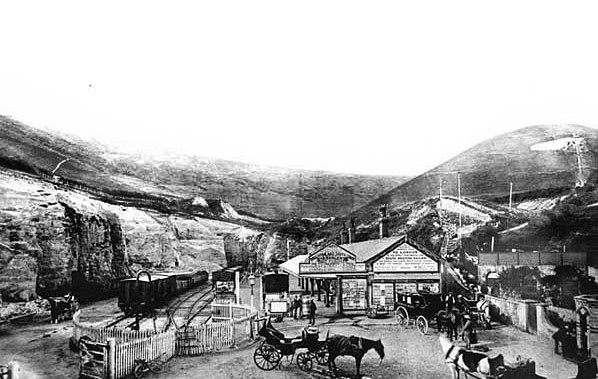
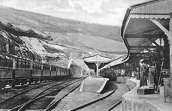
Ventnor Station
Opened in 1866. Closed in 1966.
After several failed attempts to build a railway to Ventnor, a Bill was proposed by the Isle of Wight Railway in 1860 for a line from Ryde to Ventnor. By 1864 the line had reached Shanklin but following objections from landowners the intended route through Luccombe and Bonchurch was dropped in favour of a new route from the north passing through Wroxall. This route required the construction of a 1312 yard tunnel under St. Boniface Down; the line eventually reached Ventnor in 1866.
Initially Ventnor Station was opened on the site of an existing operating quarry with only temporary accommodation provided. A permanent station was eventually built including a large goods yard with three sidings and coal ground for local merchants who were accommodated in quarried chambers in the cliff face. Although there were only two passengers roads the station was provided with three platform faces on two island platforms. The fourth platform face was for goods with a large goods shed provided at the end of the platform.
From the opening the line was well used losing little traffic to the IWCR who opened a branch from Merstone to Ventnor Town in 1900.
Ventnor Town was located a mile west of the town centre and was never well used and although the IWR station was also inconveniently sited high above the town it provided a faster and therefore more poplar route from Ryde.Ventnor Station after enlargement map early 1900s.
Ventnor Station 1890.
Ventnor Station early 1900s.
Ventnor Station 1968 and 1970.
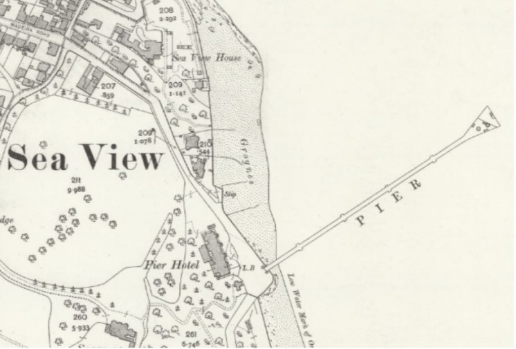
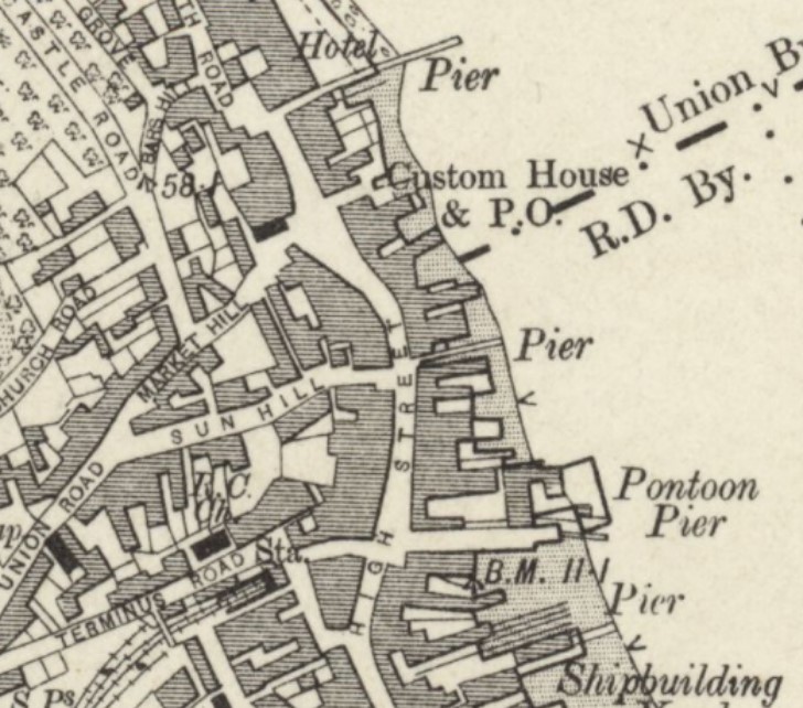
Ventnor New Royal Victoria Pier
Opened first in 1873.
In 1861, The Ventnor Pier & Harbour Co. was formed. Early plans to build two piers forming an enclosed harbour were abandoned before work was completed. The Ventnor Pier & Esplanade Co. was formed in 1870 and a new 478 foot pier was completed in 1873. A landing stage was added in 1881 but this was destroyed, along with 40 foot of pier-neck, by storms later the same year. A 650 foot, �12,000 replacement pier was opened on 19th July 1887. A �980 pavilion was added in 1906.
Steamer services ceased during World War One but resumed after 1918. The pier was sectioned in 1940 and, following a 1948 survey, was condemned. It was again rebuilt and the 683 foot �New Royal Victoria Pier� (designed by Basil Phelps) opened on 28th May 1955. However, by 1981, �750,000 was needed for repairs. A fire further damaged the structure in 1985 and, in 1988, the council agreed to transfer ownership to Ventnor Town Trust. South Wight Council promised �250,000 of the �800,000 needed, but the Trust could not generate the balance and the pier was demolished in 1992/3 at a cost of �239,500.Ventnor Pier map Mid 1900s.
Ventnor Pier Early 1900s.
Ventnor Pier 1930s.
Ventnor Pier Mid 1900s.
Ventnor Flying Ground
This was at Lawn Field St Lawrence (at or near Dean Farm on the Whitwell Road). Possibly the first use of it was on the 5 th or 6th of July 1911 when when two "Bristol " machines arrived from Shoreham. Some exhibition flights were made before the aircraft departed after 3 days stay.
During "Ventnor Week" (14th- 19th August) there was more flying activity. Two Bristol machines piloted by Mr Pizey and Mr Gordon-England came from Salisbury Plain - however Mr Gordon-England crashed 3 miles from Newport (without injury). Another arrival was Mr Valentine in a Deperdussin Monoplane who flew from Dean Farm.Ventnor Flying Meeting 1911.
Isle of Wight Railway (IWR) - Bembridge Branch
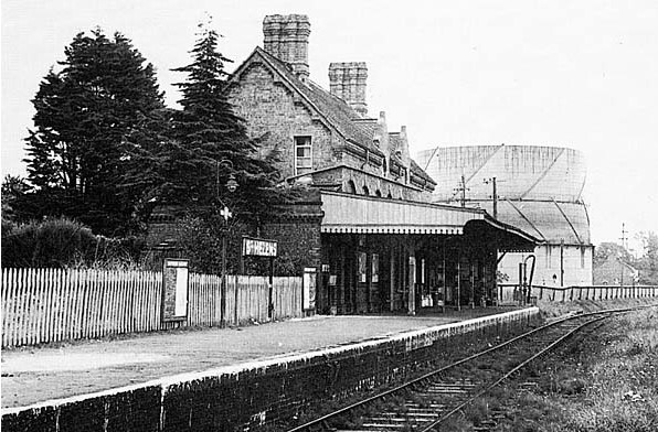
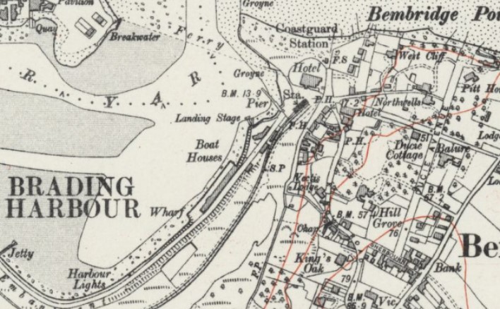
St Helen's Station
Opened in 1882. Closed in 1953.
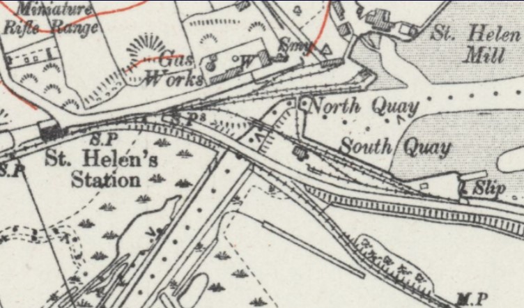
There was a short branch down to St. Helens Quay at Brading Harbour.St Helen's Station and Quay map early 1900s.
St Helen's Station 1953.
St. Helens Quay
The quay served the main commercial docks on the island until Medina Wharf was rebuilt in 1928.
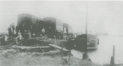
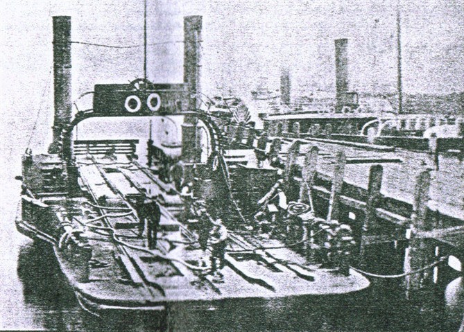
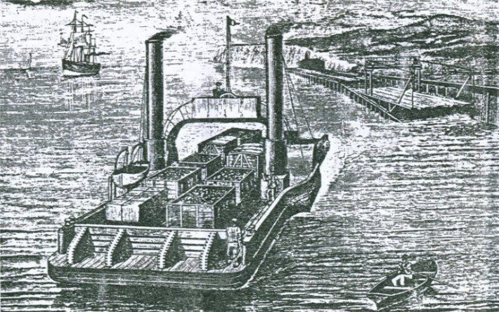
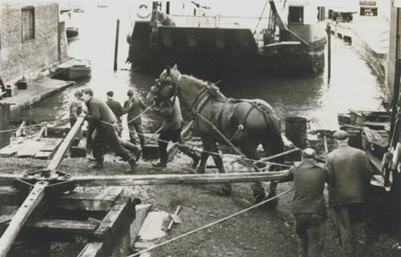
Floating Railway: The P S Carrier or "floating railway" was originally designed as a vessel to cross the River Tay. However, when the Tay Bridge was built she was transferred to the Forth as a spare vessel. In 1882 the Carrier was sold to IOWMTCo for the sum of �3,400 for use between Langston Harbour and the island berthing at St Helens. The service continued until 1888. There were major problems with the route due to the erratic sea conditions and the design of the craft. The last recorded trip was in March 1888 but there may have been others as she had been used in 1887 as a public viewing platform for Queen Victoria's fleet revue.St. Helens Quay Floating Railway late 1800s.
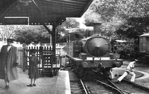
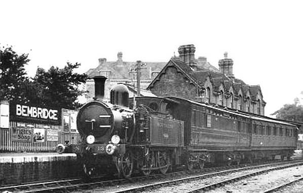
Bembridge Station
Opened in 1882. Closed in 1953.
Since the 17th C there has been various schemes to drain and reclaim Brading Marshes, none of these had been successful until the Brading Harbour Improvements and Railway Company obtained powers in 1874 to construct a 2 1/2 mile railway from the IWR at Brading to Bembridge across the reclaimed land. The scheme took eight years to complete, opening in 1882. From the outset the service was operated by the Isle of Wight Railway who bought the line outright for �430 in 1898. The line initially proved very popular and was especially busy on summer weekends.
Bembridge and Brading Harbours: Bembridge Harbour is the sole remaining intertidal part of the former much larger Brading Harbour (or Brading Haven) which extended over three kilometres inland, with a quay near Brading town. Sea walls constructed in 1338 (Yarbridge), 1562 (Bexley Point) and 1594 (Centurion's Copse � Wall Lane) steadily reduced its estuarine area. The largest and most recent enclosure via the construction of an embankment in 1879 linking St Helens to Bembridge by both rail and road, resulted in the Harbour boundaries seen today which measure only one fifth of the original River East Yar estuary. Approximately two hundred years ago, St Helens would have been a small coastal village associated with shipping, fishing and the general small scale maritime economy. Bembridge was much smaller than today and over ten kilometres away by road. The main link between the two, until the Embankment Road and Railway links were built, was by boat. The construction of the railway, plus its associated land reclamation also heralded the start of significant industry, shipping and commerce in the local area. Regular mainland boat connections were established, many boat building and engineering businesses developed and the Harbour underwent a busy and industrially developed stage from the late 19th century to around the 1950s.Bembridge Station map early 1900s.
Bembridge Station and Turntable 1950s.
Bembridge Station and Turntable 1950s.
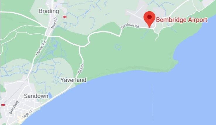
Bembridge Airport:
Opened in 1920 on land owned by Bembridge Farm and in 1921 the airfield became licensed or "approved" by the then Automobile Association and operational in 1933, the available runways were three grass strips.
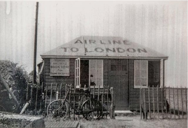
In 1934 Spartan Airlines built a terminal facility and became one of the first Isle of Wight airline services.
During the next 5 years there were various other airlines, such as Portsmouth, Southsea, Isle of Wight Aviation and Channel Air Ferries operating from Bembridge. Flight to and from Bristol, Shoreham, Heston and others were common place.
During WW II, the airport was stood down and closed and the landing area was obstructed by ditches to prevent its use in the event of invasion. Just after the war in 1945 the pre-war passenger services were not restarted, however, the airport was still active for enthusiasts. In 1948 the Bembridge and Sandown flying club began activities at the field eventually amalgamating with the East Wight Air Charter offering charter flights to the mainland. Additionally, a company called Morgan offered daily pleasure flights during the summer months.
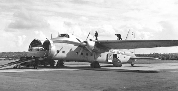
In 1952 Silver City Airways operated from Bembridge to Southampton inclusive of cars. Others were Starways (weekend and summer passenger service from Liverpool) to Bembridge, Don Everall Aviation Birmingham, Air Views Liverpool, East Anglia Flying Services.
In 1959 Britten Norman began operations in a vacant hanger, initially for hovercraft then designing new fixed wing aircraft.
In 1980 a concrete runway was added.
At the end of 2010 Britten Norman handed over the control of the airport to Bembridge airport Ltd. Due to leasing issues a closure of the airport occurred in January 2011 as there was no operational ATC in play and thus became unlicensed under the CAA. The runway is now again open for PPR or Prior Permmission Required operations.
Bembridge Airport map Today.
Bembridge Airport 1934.
Bembridge Airport Car-carrying Plane.
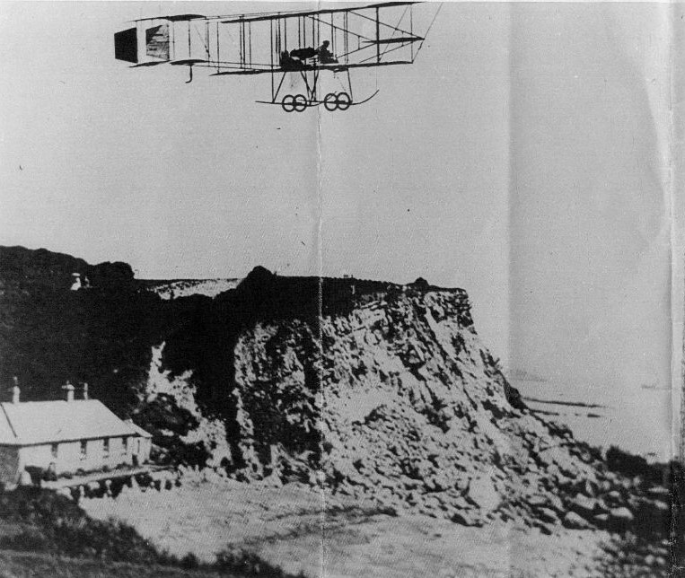
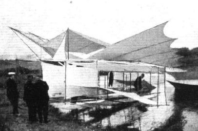
Testing a "Hydro-aeroplane" of very unusual design. St Helens 1905.
Bembridge Royal Naval Air Station:
Established in 1915 and disposed of in 1920.
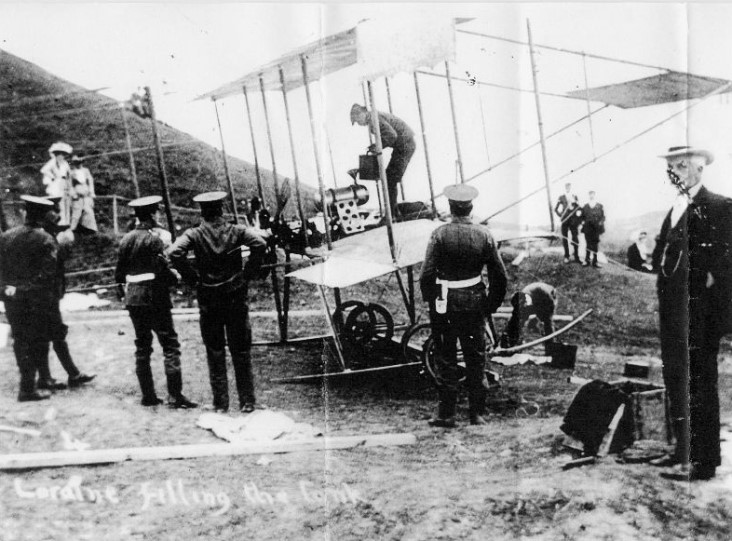
Created as a sub-unit of nearby Calshot, initially only the single slipway and some hard standing were provided. The original purpose of the station was anti-submarine warfare although later in the war more aircraft were added for general patroling duties in the Isle of Wight area.Bembridge Royal Naval Air Station 1917.
Isle of Wight Central (IWCR) - Newport to Sandown and Ventnor West
Newport Station (IWCR)
Opened in 1862. Closed in 1966.
The station was provided with a large marshaling yard where freight traffic went onwards to various destinations on the island. At one time the station was also known as Newport Central.
The railways were late in coming to the Isle of Wight. Despite several proposals and a failed Bill the first railway didn't reach the Island until 1862 when the Cowes and Newport Railway opened their line between those two towns. Two years later the Isle of Wight Railway opened a line between Ryde & Shanklin but it was a further 11 years before the two lines were linked by the Ryde and Newport Railway which diverged from the Isle of Wight Railway at Smallbrook Junction, running into a joint station with the CNR at Newport.
The Isle of Wight (Newport Junction) Railway also opened in 1875 from the IWR at Sandown through Merstone to a terminus at Newport Pan Lane; the line was extended into the joint station at Newport in 1879 and Pan Lane was closed. Within 10 years this line was virtually bankrupt.
In 1887 the Isle of Wight Central Railway was formed when the three companies amalgamated. The Newport Godshill and St. Lawrence Railway was opened from Merstone to St. Lawrence in 1897 and to Ventnor Town in 1900. The Isle of Wight Central operated this line until 1913; it was then bought by the Central. Despite being closer to the town centre than the IWR station high above the town the new station failed to capture much traffic from its competitor.
All the islands railways were absorbed into the Southern Railway in the 1923 grouping and the service was soon upgraded with the introduction of new rolling stock and a revised timetable that included some through running between the various lines. The Southern Railway itself became part of the Southern Region of British Railways after nationalisation in 1948 and initially there were few changes. However this was short lived; improved bus services and the popularity of the motor car soon led to dwindling passenger numbers. Merstone - Ventnor was the first line to close in 1952 followed by the former Freshwater Yarmouth and Newport Railway in 1953 and the Newport - Sandown line in 1956.
The remaining line between Cowes and Smallbrook Junction survived until 1966.
Closed in 1966, the station served as a base for the Wight Locomotive Society until January 1971, when the site was demolished by scrap merchants.
The southern end of the Isle of Wight Railway between Shanklin and Ventnor was also closed.Newport Station map Early 1900s.
Newport Station date unknown.
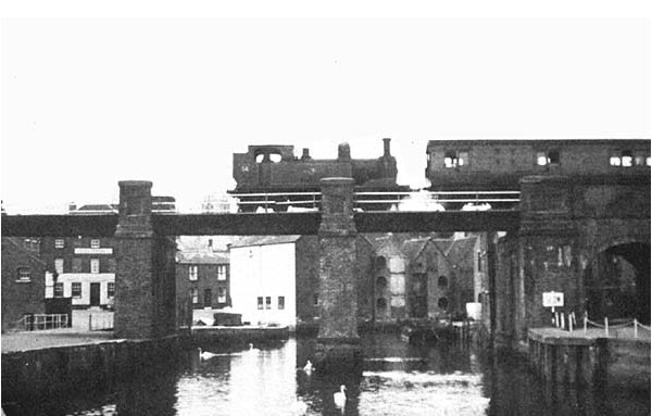
Newport Station approach over the Medina 1960s.
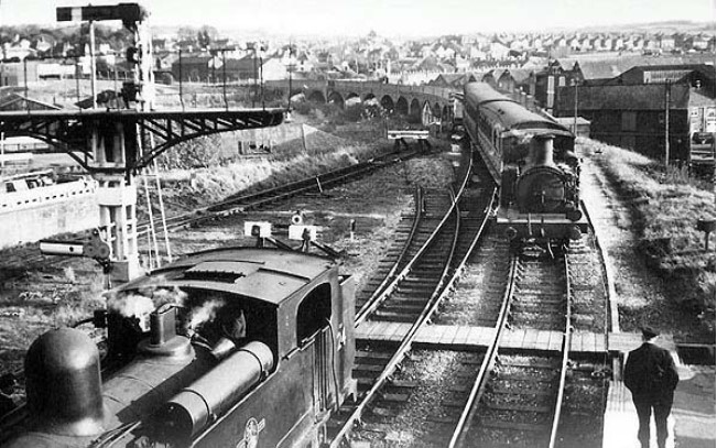
Newport Station 1965.
Newport Station 1966.
Newport Station 1969.
Newport Pan Lane Station (IWCR)
Opened in 1875 by Newport Junction Railway. Closed in 1879.
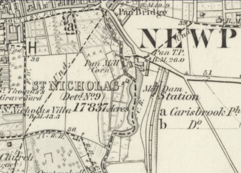
Newport Pan Lane Station opened on 11th August 1875 as the northern terminus of the Newport Junction Railway. It was opened without Board of Trade approval and was ordered to close again eventually reopening with authority on 6th October 1875. The station was only a temporary terminus and was closed on 1st June 1879 when the line was extended northwards to join the Ryde and Newport Railway at Newport Station. Pan Lane station became Pan Lane crossing. A private siding served the adjacent Pan Mill but this was taken out of use in the 1930s.Newport Pan Lane Station and Pan Mill siding map late 1800s.
Site of Newport Pan Lane Station.
Newport Pan Mill siding.
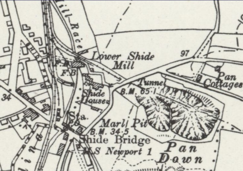
Shide Station (IWCR)
Opened in 1875 by Newport Junction Railway. Closed in 1956.
Shide was the terminus of the line from Sandown for seven months while work was completed on the line up to the temporary terminus at Pan Lane, Newport.
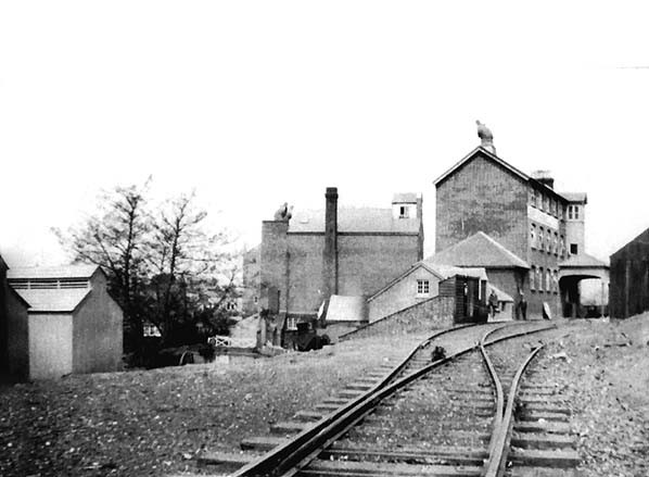
Situated near Shide Chalk Pits it was a sparsely used station whose main purpose was to transport raw materials needed for the Island�s cement industry. It was doomed when production ceased during the Second World War.Shide Station and Marl Pit map early 1900s.
Shide Station 1950s.
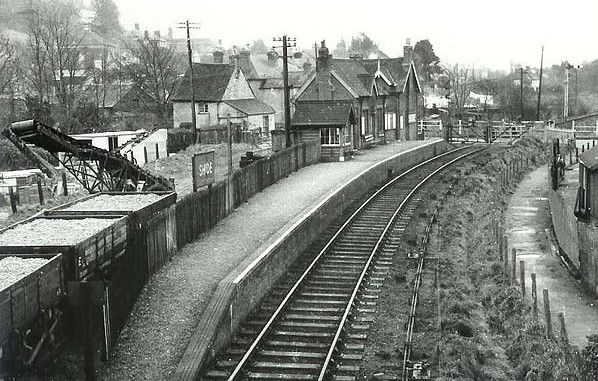
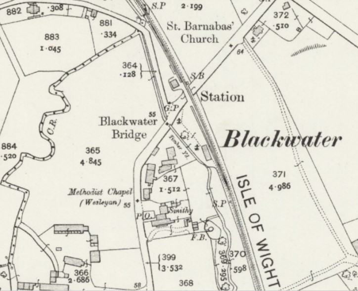
Blackwater Station (IWCR)
Opened in 1875 by Newport Junction Railway. Closed in 1956.
Line opened 1.2.1875 but Blackwater Station probably opened later and first appeared in a public timetable June 1876
The station was opened as Blackwater but renamed Blackwater (Isle of Wight) in 1923. It was a rural station whose "heyday was before the advent of the motor car", during the inter-war years it was known for its large collection of enamel advertising boards.Blackwater Station map early 1900s.
Blackwater Station 1950s.
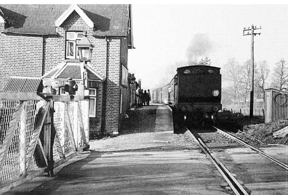
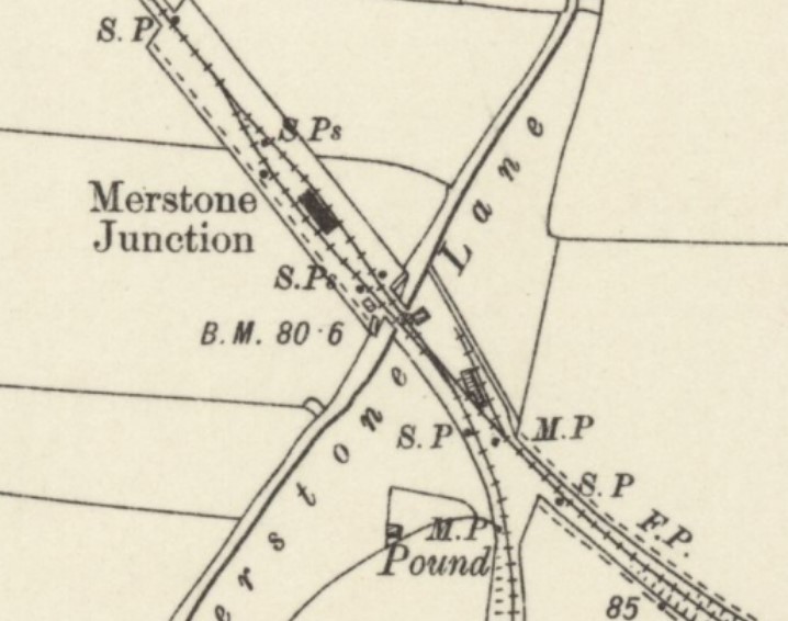
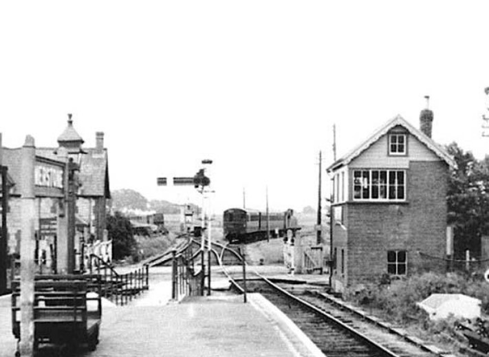
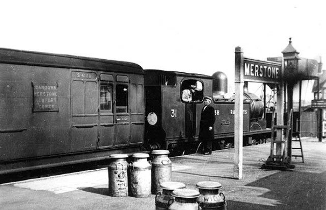
Merstone Station (IWCR)
Opened in 1875 by Newport Junction Railway. Closed in 1956. Originally named Merstone Junction and changed to Merstone in 1911.
When opened the station had a single platform but with the opening of the Newport, Godshill & St. Lawrence Railway in 1897 the station was rebuilt with an island platform. The isolated position meant that the station never generated much passenger traffic and was at its busiest when passengers used the station to interchange between trains on the Sandown and Ventnor lines.Merstone Station map Early 1900s.
Merstone Station 1950s.
Horringford Station (IWCR)
Opened in 1875 by Newport Junction Railway. Closed in 1956.
It was intended that the station should open in May 1872 but an inspection before that date was unsatisfactorily. Despite permission to open being refused a service to Sandown started on 28th May 1872. This was maintained by the contractor but ceased by 27th July 1872. The authorised service began on 1st February 1875.Horringford Station and Gravel Pit Branch map Early 1900s.
Horringford Station 1950s.
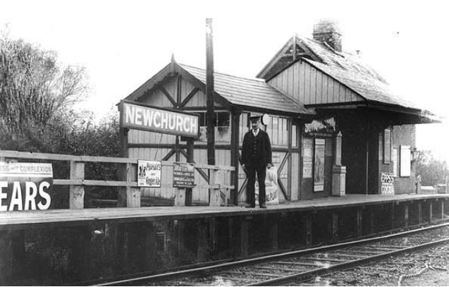
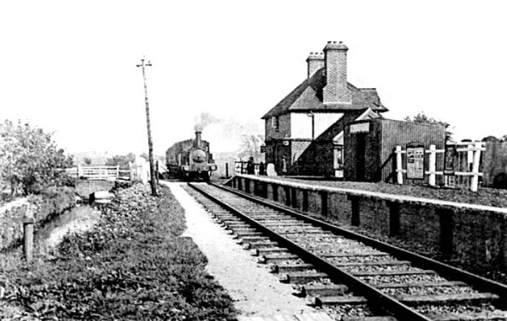
Newchurch Station (IWCR)
Opened in 1875 by Newport Junction Railway. Closed in 1956.Newchurch Station map early 1900s.
Newchurch Station early 1900s.
Newchurch Station 1960s.
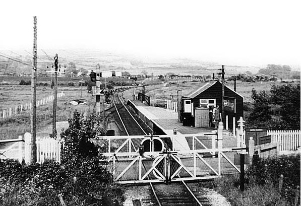
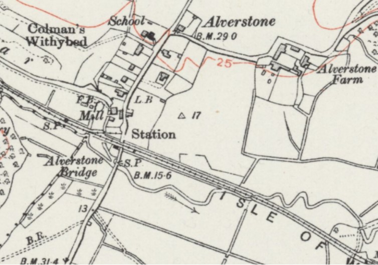
Alverstone Station (IWCR)
Opened in 1875 by Newport Junction Railway. Closed in 1956.Alverstone Station map mid 1900s.
Alverstone Station early 1900s.
Sandown Station (IWCR) - see Sandown (IWR)
Godshill Station (IWCR)
Opened in 1897 by Newport, Godshill & St. Lawrence Railway. Downgraded to an unstaffed halt in 1927 and closed in 1952.Godshill Station map Early 1900s.
Godshill Station 1950s.
Whitwell Halt Station (IWCR)
Opened in 1897 by Newport, Godshill & St. Lawrence Railway. Downgraded to 'partially unstaffed' (summer season only) in 1928 and further downgraded to an unstaffed halt and goods depot in 1941. Closed in 1952.
The station was originally named Whitwell. At the time of opening the route was popular featuring a passing loop and two platforms, the only station on the line to have this. It was renamed Whitwell Halt on in 1941Whitwell Halt Station map early 1900s.
Whitwell Halt Station early 1900s.
St. Lawrence Station (IWCR)
Opened in 1897 by Newport, Godshill & St. Lawrence Railway. Downgraded to an unstaffed halt in 1927. Closed in 1952. The station was originally named Ventnor (St. Lawrence) and was renamed St. Lawrence on the opening of Ventnor Town.
St. Lawrence was the temporary terminus of the branch from 1897 until the terminus at Ventnor Town was opened in 1900.St. Lawrence Station map early 1900s.
St. Lawrence Station 1950s.
Ventnor West Station (IWCR)
Opened in 1900. Closed in 1952. The station was originally named Ventnor Town and was renamed Ventnor West in 1923.
The station was inconveniently situated for the town, being some distance west of the town centre and 168 feet above sea level. Consequently, it never lived up to the expectations of the operators.
Plans were made to extend the line beyond the station to a new terminus (Ventnor Central) closer to the Town Centre opposite the Royal Hotel. However, the combination of newly built housing on the proposed formation along Park Avenue and the company's ailing finances meant this scheme was never realised.Ventnor West Station map early 1900s.
Ventnor West Station 1950s.
Ventnor West Station 1957.
Isle of Wight Central (IWCR) - Newport to Ryde
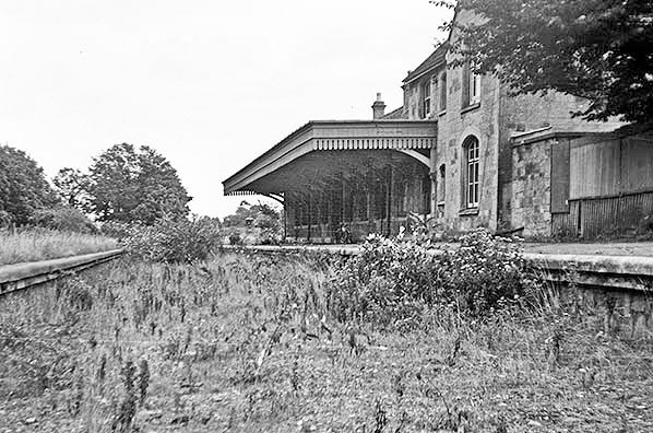
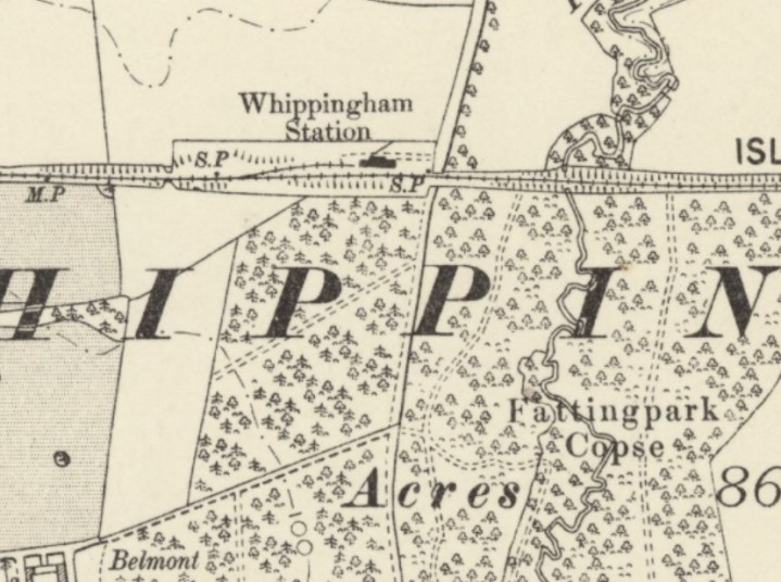
Whippingham Station (IWCR)
Opened in 1875 by Ryde & Newport Railway. Closed in 1953.
Despite its very isolated location the station was a grandiose building built solely because of the need to have a station within reasonable proximity to Queen Victoria's Island residence Osborne House, and in its early years it was for private use only but eventually became a public station although initially trains only stopped by request.Whippingham Station map early 1900s.
Whippingham Station 1953.
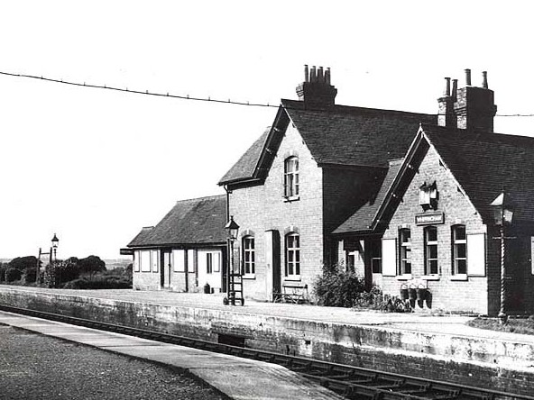
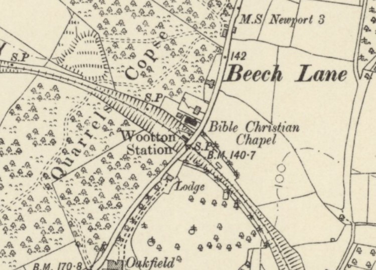
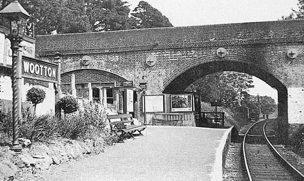
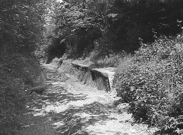
Wootton Station (IWCR) and (IWSR)
Opened in 1875 by Ryde & Newport Railway. Closed in 1953. The line itself closed in 1966 and re-opened in 1971.
The platform extended under the arch of the Station Road overbridge The booking office and waiting room were built into an adjacent arch. The stationmaster's house was built alongside the road in 1907 and in 1910 the platform was extended to accommodate longer trains. Earth movements on the bank forced premature closure of the station in 1953.
Part of the line was re-opened as the heritage Isle of Wight Steam Railway in 1971. A new station at Wootton, about two hundred yards to the south east of the original, was opened in August 1986, and is now recreated in the style of an Isle of Wight Central Railway-era station.Wootton Station map early 1900s.
Wootton Station 1950.
Wootton Station 1975.
Wootton Station Today.
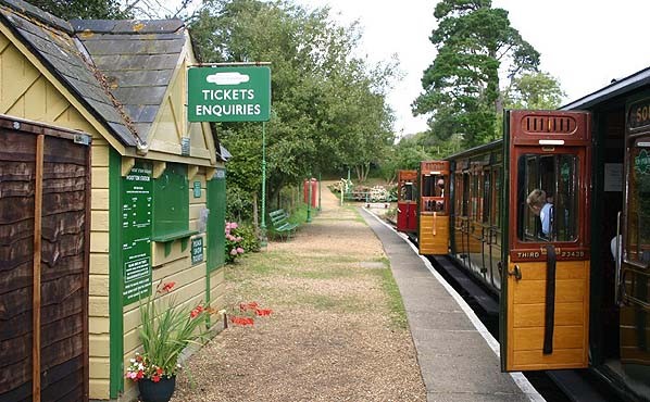
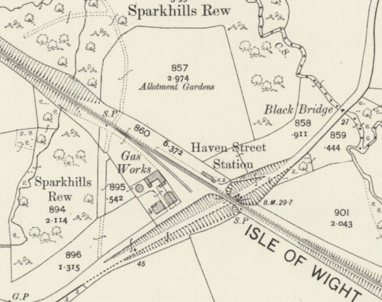
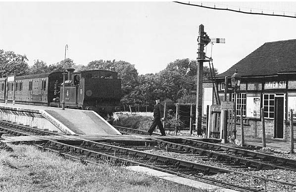
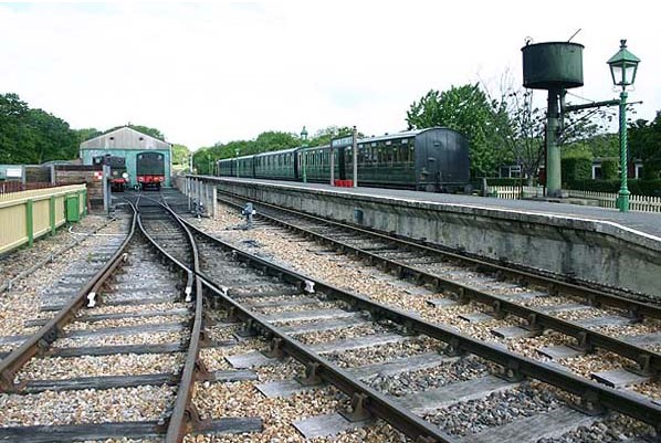
Havenstreet Station (IWCR) and (IWSR)
Opened in 1875 as Haven Street by Ryde & Newport Railway. Renamed Havenstreet in 1958. Closed in 1966 and re-opened in 1971 and is now the headquarters of the Isle of Wight Steam Railway.
The original station had a single platform. A siding was later added to serve a small gasworks opposite the station. Although the gasworks closed in the 1920's the siding remained in use.
Developments since re-opening have included the construction of a locomotive works, carriage and wagon repair works, additional sidings and a caf�. Additionally, the former gasworks has been opened to the public as a shop and museum, the water tower formerly at Newport was re-erected at Havenstreet in 1971.
Havenstreet Station map early 1900s.
Havenstreet Station 1910, 1953, 1966 and Today.

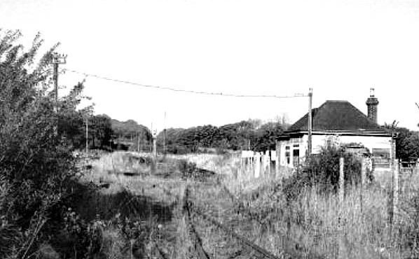
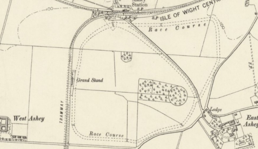
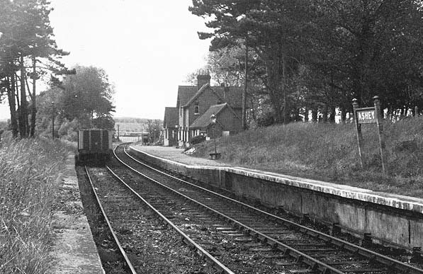
Ashey Station (IWCR) and (IWSR)
Opened in 1875 by Ryde & Newport Railway. Reduced to unmanned halt statusin 1953. Closed in 1966 and re-opened in 1993.
From the down loop a siding ran south to a chalk quarry under Ashey Down, this also served an adjacent racecourse which had its own station until about 1930. In 1926 the platform was extended to accommodate longer trains;
It was resited in the 1950s because of subsidence at the original site, it was also described in some timetables as Ashey for Nunwell.
The horse racing tradition is continued to this day with the staging of the Ashey Scurry and Isle of Wight Grand National each March. A special train service is provided by the Steam Railway on what is this normally peaceful rural station�s busiest day of the year.Ashey Station and Race Course map early 1900s.
Ashey Station 1950s.
Ashey Racecourse Station (IWCR)
Opened in 1884 by Ryde & Newport Railway. Closed in 1929.
Ashey Racecourse Station was on a siding running south to a chalk quarry under Ashey Down. Ashey and Ashey Racecourse Stations were particularly busy on race days in the years preceding closure in 1929. The station never appeared in a public timetable.
The 1919 Ordnance Survey map shows the quarry siding and the racecourse but the station is not shown but was probably by the racecourse grandstand.
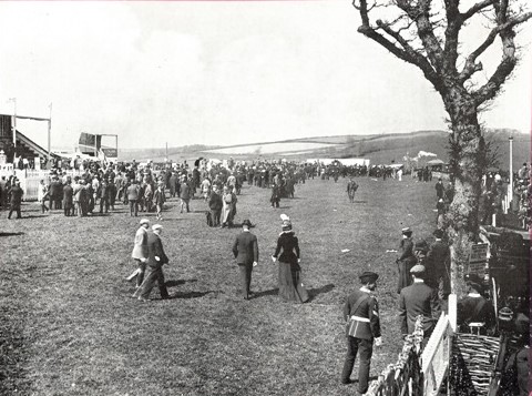
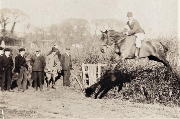
Ashey Racecourse: Opened in 1884.
Included was a grandstand which burned down in 1929 and was never rebuilt and the course was abandoned.
Ashey is now the site every year of an amateur horse race known as the "Isle of Wight Grand National and Ashey Scurry". There are four races that include jumping over fences. It is open to horses and ponies of all sizes and breeds. Riders of all ages enter.
Ashey Racecourse early 1900s and Today.

Smallbrook Junction Station (IWSR)
The station was opened in 1991 by British Rail when the Isle of Wight Steam Railway was extended to reach the Island Line, in order to provide a passenger interchange between the two. It is only served on days that both the Island Line and the Steam Railway are open, as there is no access either by path or by road. Prior to 1991 there was no station on this site, but it was still an important railway junction. "Smallbrook Junction" is the historic name, long predating the station. Between 1875 and 1926 there were two separate lines here, independently run by the Isle of Wight Central Railway and the Isle of Wight Railway. In 1926, following the island's rail network passing to the Southern Railway, a signal box and turnouts were installed at Smallbrook. From then until 1966, the line was the Junction between the Ryde Pier Head to Ventnor and Ryde Pier Head to Cowes Lines.Smallbrook Junction Station map early 1900s.
Smallbrook Junction Station Today.
Isle of Wight Central (IWCR) - Newport to Cowes
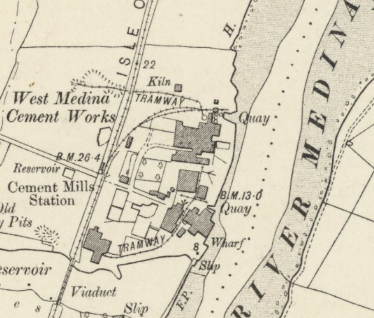
Cement Mills Halt Station (IWCR)
Opened in 1879 by Cowes & Newport Railway. Closed in 1966.
Although never appearing in a public timetable, Cement Mills was a public halt mainly for factory workers but also used by fishermen and local people. Once the cement mills closed the halt was also officially out of use but trains continued to stop on request from fishermen and ornithologists.
Cement Mills at Dodnor:The River Medina was one of the main trade routes onto the Island and in the 18th Century two tidal mills had been built on each side of the river.
In 1791, the West Medina Mill at Dodnor was sold to William Porter, a miller and meal man who sold pies in Newport. Unfortunately, this venture was not successful and after a varied history of use as barracks and as storage space for local merchants, the site was sold to Charles Francis, a cement maker from London in 1841.
The River Medina proved to be an excellent source of the Septaria stones from which Roman cement was made, as well as providing the tidal power of the old mill and easy access to the sea for delivery of the finished cement. In fact, when mixed with stones dredged from the river, the cement produced proved to be much harder than normal Roman cement and was called Medina Cement. It was highly regarded and won prizes at several exhibitions, but by the early 1850s production had changed to a new, more improved type of cement, called Portland Cement. Jobs around the site ranged from quarry men who worked the chalk from Shide chalk pit, to chemists, cement testers, mariners taking raw materials and finished cement on barges, to carpenters, coopers, sack repairers and even a �tally-boy�.
Men loading the kilns worked stripped to the waist to combat the heat and drank a mixture of oatmeal in water to try and protect them against the noxious fumes.
The fired clinker was drawn from the kilns whilst it was red hot and it was back-breaking work with each kiln burning for days. The men were paid by results, so if a firing was unsuccessful, their wages were reduced.
Cement production continued at the site until 1939, with production methods evolving and buildings and machinery being abandoned as new technology came along. After the Second World War, production ceased and the site became a supply and distribution centre, before closing in the latter years of the century and being demolished to create new factory space.Cement Mills Halt map early 1900s.
Cement Mills Halt 1954.
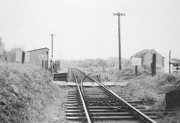
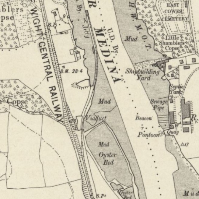
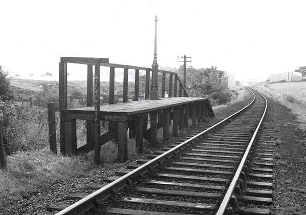
Medina Wharf Halt (IWCR)
Opened in 1896 by Cowes & Newport Railway. Closed in 1966.
Medina Wharf was opened in 1878 for unloading coal and merchandise. A private halt was provided for workmen. It never appeared in a public timetable.Medina Wharf Halt map early 1900s.
Medina Wharf Halt 1960's.
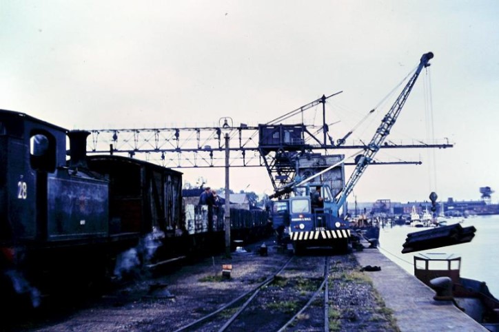
Medina Wharf 1960's.
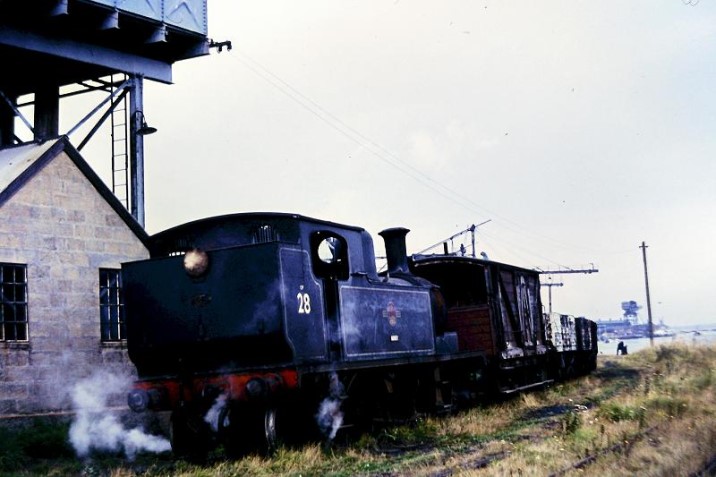
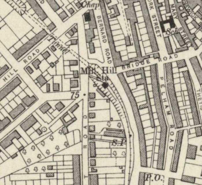
Mill Hill Station (IWCR)
Opened in 1862 or 1871 by Cowes & Newport Railway. Closed in 1966.
Unlike many of the Island's railway stations, Mill Hill was busy at the beginning and end of each working day, depositing and picking up hundreds of workmen from shipyards.Mill Hill Station map early 1900s.
Mill Hill Station 1961.
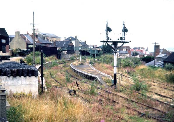
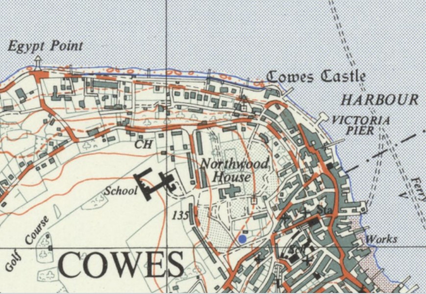
Cowes Station (IWCR)
Opened in 1862 by Cowes & Newport Railway. Closed in 1966.
The station was rebuilt in 1891. The track layout was again altered in 1918. Because of its poor siting well away from the ferry terminal the station never attracted the expected traffic.
In its later years Cowes station was notable for an unusual operating procedure. The engine would propel its empty carriages backwards up the 1 in 95 gradient towards Mill Hill and then run forward and round the train using a crossover. The carriages were then allowed to run back down into the station by gravity, controlled by handbrake by the guard, and the locomotive was reattached to haul its train back to Newport and Ryde.Cowes Station map early 1900s.
Cowes Station 1960s.
Cowes Station 1970s.
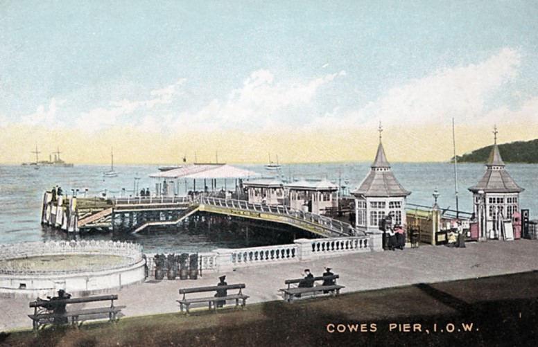
Cowes Victoria Pier
Opened in 1902.
After the destruction of Royal Pier, the people of Cowes were still determined that their town should have a pier. Not only would it increase the status of Cowes, but pleasure steamers were taking tourists elsewhere - only the regular ferries docked at Fountain Pier, and so most pleasure steamers travelled to Bournemouth, Swanage and Poole, but not Cowes. The Southampton, Isle of Wight and South England Royal Mail Steam Packet Company charged excessive tolls for any other ferry wishing to use their pier, and so the tourists went elsewhere at the expense of Cowes.
In 1897 there were proposals to convert Watch House Slip into a pier, but that was abandoned when an idea to build a pier at the Zig Zag emerged, but that was considered too far away from the town. Finally in October 1899 a proposal for a pier on The Parade near Bath Road was approved, and the Cowes Pier Act was passed in the summer of 1900.
The first steamer to call at the pier was the Monarch, on April the First, 1902. The pier proved so successful that after the first season, two shelters were built and a pavilion soon after. The highlights of Cowes Week all centred around the pier, and from that point on, the pier was in almost continuous use until the Great War.
During the Great War, most of the paddle steamers that had called at the pier were used for War work, and the pier itself was used by troops departing to France and Gallipoli. Between the wars, the pier became popular again, but at the outbreak of the Second World War, the pier was taken over by the Royal Navy. It was at this time that the pier was damaged by fire, and the pavilion was demolished in 1951. Despite attempts to restore the pier, it was finally demolished in 1962.Cowes Victoria Pier map mid 1900s.
Cowes Victoria Pier early 1900s.
Other Cowes Piers
Fountain Pier built around 1840 and removed about 1893. It was replaced by the pontoon, which is still used for the high speed service to Southampton.
Royal Pier was built in the late 1860s - washing away in 1876.
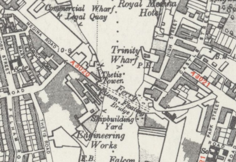
Cowes Floating Bridge
Opened in 1859.
The ferry crosses the tidal river from East Cowes to Cowes.
Before any kind of floating bridge existed, a rowing boat ferry operated between Cowes and East Cowes transporting pedestrians only. This service was owned and operated by the Roberton family from 1720 to 1859. From 1842 carriages and animals could be transported across using a pontoon which was winched across under horse power (used until 1973). In 1859 the Floating Bridge Company was formed and bought the ferry rights. From 24 November 1859 the first steamboat was used, built on the River Itchen in Southampton. In 1868 the ferry was bought by The Steam Packet Company (which now trades as Red Funnel), and bought a new ferry for the service in 1882.
Cowes Floating Bridge Map early 1900s.
Cowes Floating Bridge 1896.
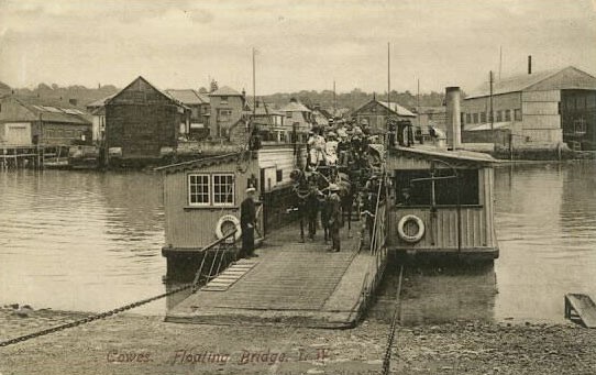
Cowes Floating Bridge 1936. Showing horse-powered winch manoeuvring the ferry onto the maintenance slip.
West Cowes Airport
Also known as Somerton or just Cowes. The period of operation was Military 1918 to 1919 and Civil 1930 to 1951.
First use of the airport was during the early part of WW1 when J.Samuel White and Co. used a field at Three Gate Cottages, Northwood, (probably at "B" in map below) to fly landplanes built in their factory at Cowes.
In 1916 Whites purchased the land marked as "A" on the map and set up an airfield which opened at the end of March 1916. In addition a site ("C") was purchased and a new factory was built. The RAF used the aerodrome in 1918 and 1919, basing the Coastal Battery Co-operation School aircraft there (a dozen BE2Cs). However with the end of WW1, the RAF left in late 1919, and Whites having ceased aircraft production in July 1919, the airfield lapsed into (temporary) disuse.
During the early 20s the airfield operated as an unlicensed aerodrome used by light aircraft and gliders. From 1929 Saunders (later SARO) took over the airfield and used it for flight testing. SARO were joined on 20th February 1931 by Spartan Aircraft who moved into the buildings previously used by J.S.White.
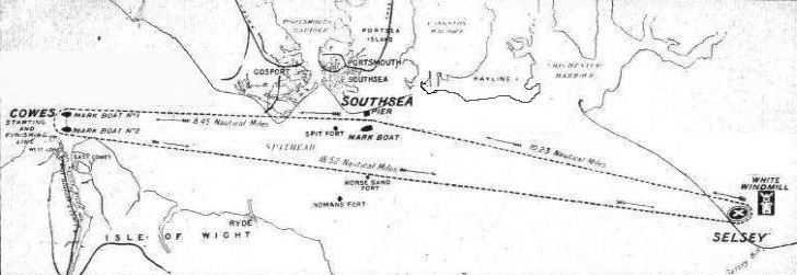
In 1923 the Schneider Trophy Contest was held in Cowes, on September 28. The start and finish of the 186 mile course was located at Cowes, and there were turning points at Selsey Bill and Southsea. The race was won by David Rittenhouse for the USA.
From April to October 1933 Spartan Air Lines operated a regular service to Cowes from Heston (west London). In those days it was common for many if not most airlines to operate seasonal regional services when the weather was liable to be favourable. Passengers would check in and be bused from the Airway Terrminus in Victoria Station, being the Headquarters of Imperial Airways, to Heston. There were also flights from Gatwick in the 1930s.
Spartan was absorbed by British Airways in 1936, and services ceased when WW2 commenced in 1939.
During WW2 all other Isle of Wight airfields were closed and the landing areas obstructed. Somerton remained open as a communications airfield, being used mainly by Saunders-Roe, but any other activity was minimal until the end of the war.
In August 1946, Somerton Airways was formed and operated freight and passenger flights from the airfield. In 1951, the airline ceased operations. This in turn led to the closure of the airfield.
West Cowes Airport map 1920s.
Cowes Schneider Trophy winner 1923.
Cowes Schneider Trophy Course 1923.
West Cowes Airport 1930s.
A Sandringham "Frigate Bird III" at West Cowes 1950s.

East Medina/East Cowes Aerodrome
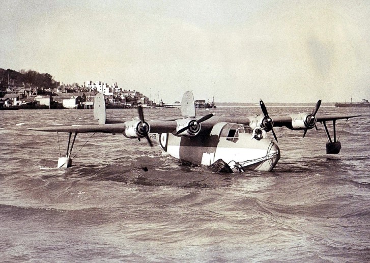
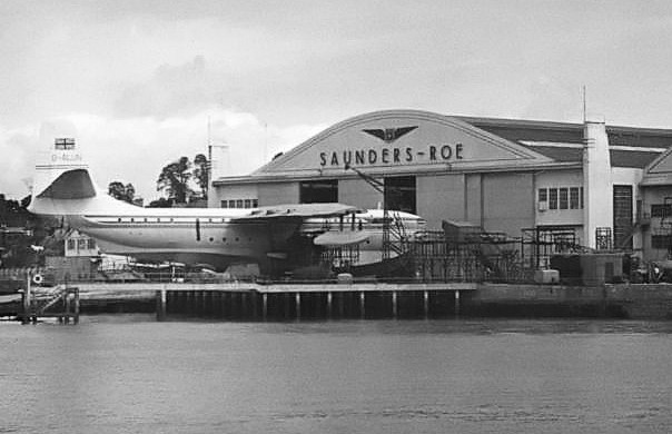
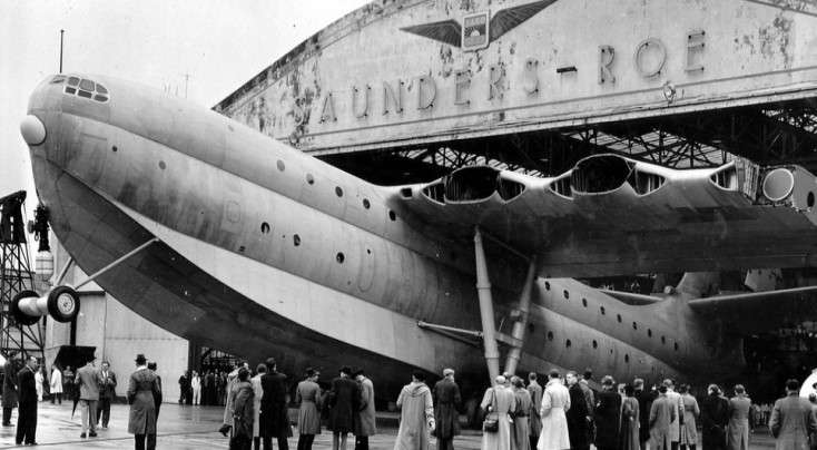
East Cowes was once home to the aircraft manufacturer Saunders Roe, who built the large, advanced, flying boat The Saunders-Roe Princess, as well as the Black Knight rocket and the Black Arrow satellite carrier rocket. They also developed and tested the first hovercraft.
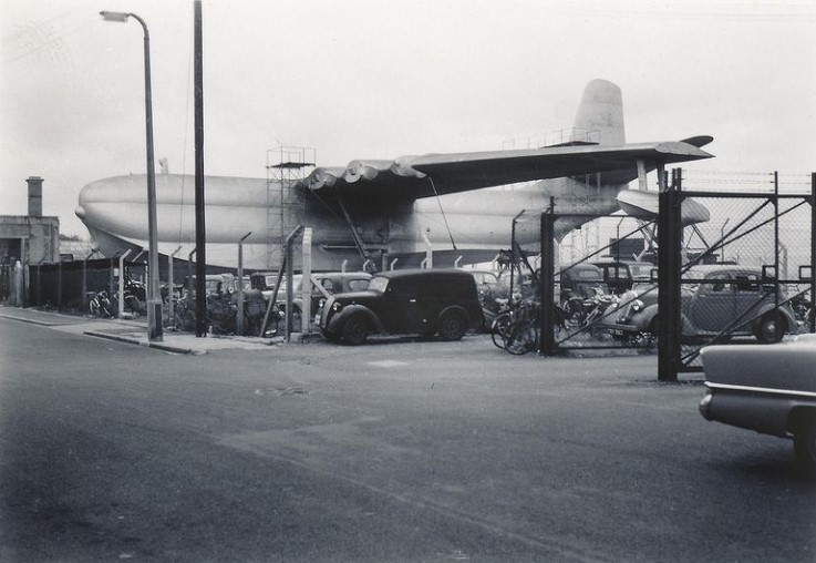
Work on the Princess was ultimately cancelled after having produced three examples, only one of which flew. By the mid-1950s, large commercial flying boats were being increasingly overshadowed by land-based jet airliners. Following the project�s termination, the three airframes were stored with the intention of selling them on; however, upon receipt of a promising offer for the aircraft, it was found that corrosion had set in while in storage. As a result, all three aircraft prototypes were subsequently scrapped.East Cowes Seaplane.
Saunders Roe East Cowes works with Princess flying boat 1950s.
Princess Flying Boat at East Cowes 1950s.
Princess Flying Boat waiting to be scrapped at East Cowes 1950s.
Medina Boatyards
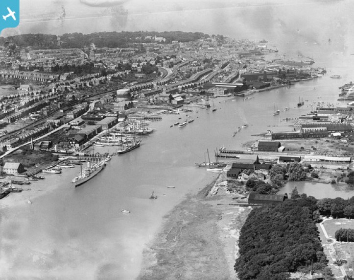
J. Samuel White: The grandfather of John Samuel White moved from Broadstairs to East Cowes in 1802 and acquired the shipbuilding site on the east bank of the River Medina where there was already more than a century of shipbuilding tradition. In the closing years of the Napoleonic War he began work on what would become the 'Thetis' Yard across the river on the West bank on the 'salterns' and marsh between the Medina and Arctic roads. It opened officially on 1 October 1815. White subsequently rebuilt the east bank site which in 1825 became the Falcon Yard. It rapidly became a world leader in the design and construction of small- to medium-sized naval and merchant ships.
In 1912 the company began constructing aircraft at East Cowes. Between 1912 and 1916 the company moved its aircraft manufacturing facilities across the river to Cowes and built a number of seaplanes
The general decline of shipbuilding in Britain led to the launch of the last vessel for the Royal Navy in 1963 and the closure of the shipyard. In 1981 the company finally ceased trading.
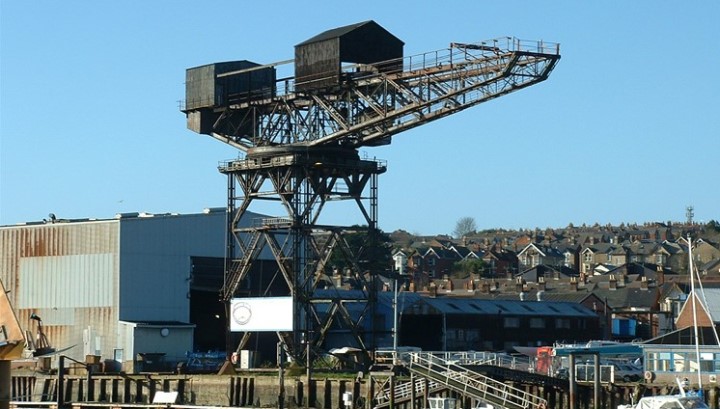
The hammerhead crane: An order in 1911 of six destroyers for the Chilean Navy led to an expansion of the yard and the purchase of a large 80 ton hammerhead crane. The crane was installed in 1912 and still survives, last used in 2004, and now Grade II* listed.
The term 'hammerhead' is often applied to these cranes but, strictly speaking, it refers to the design of the German 'hammerkran' crane, a few of which were built for British shipyards at the start of the century. The British giant cantilever crane was of quite different design and ultimately more widely developed.
The first example was of a design dictated by a particularly demanding topography on Wreath Quay, Sunderland in 1905. Thereafter the cranes were specified by all the leading shipbuilders, port authorities and navel dockyards. They were built on the Clyde from 1907 and continued in England, on the Tyne, from 1909, mostly of around 150-200 tons. In the following decades they were erected at major shipyards in Britain and throughout the world, right up into the 1970s. In total around 60 were built worldwide.Cowes Hammerhead Crane.
Cowes Ships 1932.
Freshwater, Yarmouth and Newport Railway (FYN)
In 1868 there was a proposal to build a line from Newport to Freshwater at the western end of the island. This initial proposal came to nothing but in 1880 the Freshwater, Yarmouth and Newport Railway Company were authorised by to build a 12 mile single track line with three passing places from the Isle of Wight Central Railway's station at Newport to Freshwater.
From the start the service was provided by the Isle of Wight Central Railway who provided the staff and the rolling stock while the FYN was responsible for maintaining the line. This did not prove to be a satisfactory arrangement and after bankruptcy in 1896 the partnership was eventually dissolved in 1913 when the FYN bought its own locomotives and rolling stock. The company also built its own station 200 yards west of the IWC station at Newport. Initially transferring passengers had to walk between the two stations but by June 1914 trains were allowed to run between the two stations saving passengers the walk. The line was not financially successful with the company operating in bankruptcy until 1923 when it was taken over by the Southern Railway as part of the general grouping. Shortly after the takeover the FYN station at Newport closed with all trains running in to the IWC station. Improvements were made with some through trains running between Freshwater and Ventnor but following nationalisation in 1947 the lines days were numbered. In 1952 it was proposed to close the line and following a public inquiry, closure was approved with the last train running on 20th September 1953
Newport Station (FYN)
Opened by the Freshwater, Yarmouth and Newport Railway in 1913. Closed in 1923.
Trains on the FYN line originally (from 1888) ran from he Newport (IWCR) station. Following the break with the IWCR in 1913, the FNY had its own station with a wooden platform. Situated on same road as Newport (IWCR) station but on the opposite side. In 1923 the station was closed and Freshwater trains reverted to using Newport's main station. During its inauspicious existence passengers had a short inconvenient walk between the two rival termini.Newport Station (FYN) map 1920s.
Newport Station (FYN) 1920.
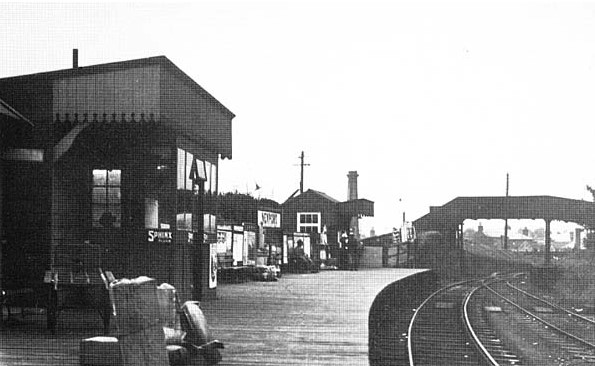
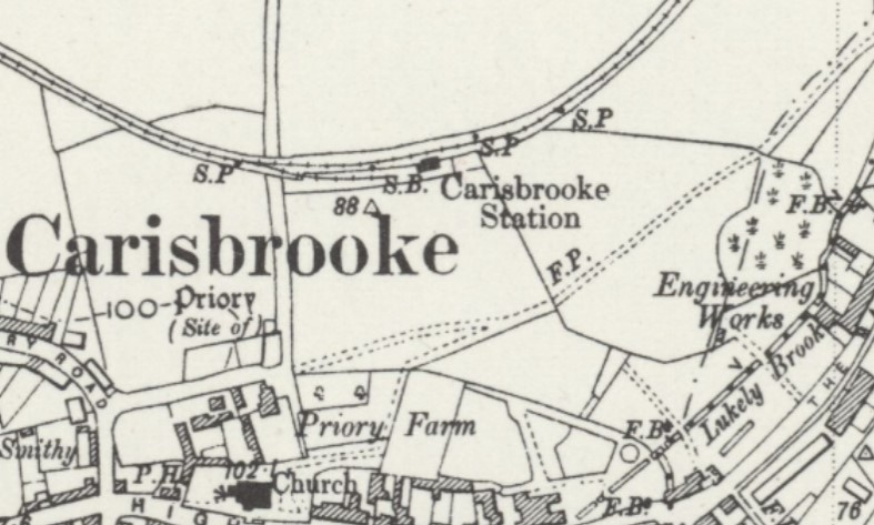
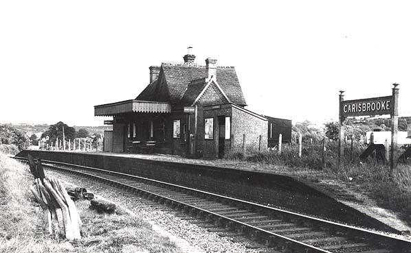
Carisbrooke Station (FYN)
Opened by the Freshwater, Yarmouth and Newport Railway in 1889. Downgraded to a halt 1927. Closed in 1953.
There was a 200 yard goods siding behind the down platform but the yard was never well used except in WW2 when prisoners from Parkhurst were employed loading sugar beet into wagons. After the war the station saw little goods traffic. The up platform loop was abandoned in 1927 when the station was downgraded to a halt. Prior to the widespread introduction of busses Carisbrooke was one of the busiest stations on the island but few tourists used the station in later years despite the castle being close by.Carisbrooke Station map early 1900s.
Carisbrooke Station 1953.
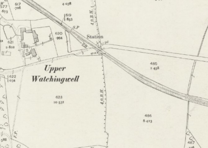
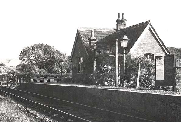
Watchingwell Halt (FYN)
Opened by the Freshwater, Yarmouth and Newport Railway as a private station in 1889 and made public in 1923. Downgraded to a halt 1948. Closed in 1953.
Watchingwell Station was built by Southampton MP Sir John Harrington Simeon (a director of the London and South-Western Railway) for the use of his family, friends, tenants and those having business at the estate. It first appeared in a public timetable in August 1923. The station had a 140' long siding. The goods service was withdrawn in mid 1948 when the station was downgraded to a halt.Watchingwell Halt map early 1900s.
Watchingwell Halt 1953.
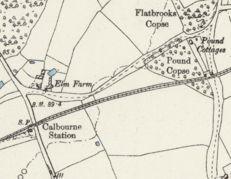
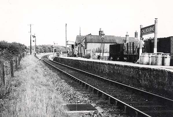
Calbourne & Shalfleet Station (FYN)
Opened by the Freshwater, Yarmouth and Newport Railway in 1888 for freight and 1889 for passengers. Closed in 1953.
Was also known as just Calbourne.Calbourne & Shalfleet Station map early 1900s.
Calbourne & Shalfleet Station 1953.
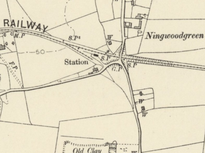
Ningwood Station (FYN)
Opened by the Freshwater, Yarmouth and Newport Railway in 1888 for freight and 1889 for passengers. Closed in 1953.
Ningwood Station map early 1900s.
Ningwood Station 1953.
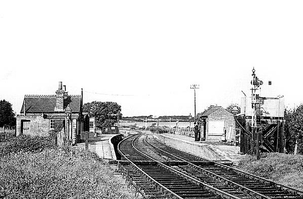
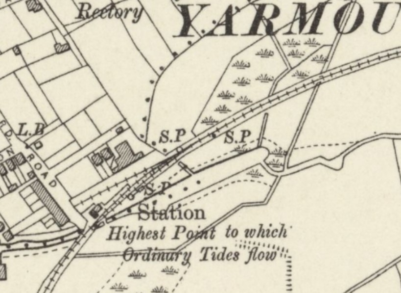
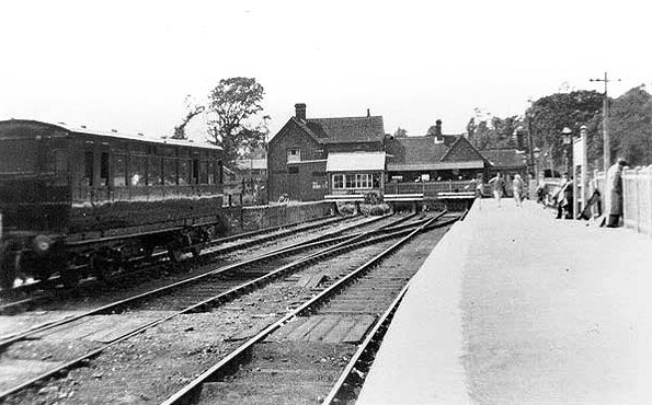
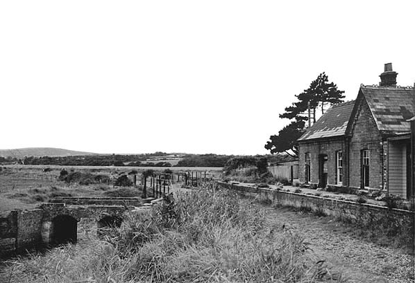
Yarmouth Station (FYN)
Opened by the Freshwater, Yarmouth and Newport Railway in 1888 for freight and 1889 for passengers. Closed in 1953.
The station originally had a long passing loop with a second platform; the loop was disused by the 1920's and later removed. Unusually the two platforms were staggered due to a stream that passed under the line near the end of the up platform. One of the platforms was removed in 1923. There was a 320' single line siding serving a small goods yard behind the up platform.
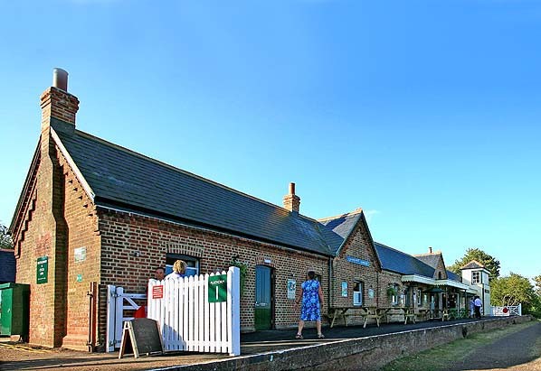
The station has (2014) been restored to a high standard; this includes the addition of a replica station building at the north end of the original building. There is also an imitation signal box on the platform which is used as a bird hide. The station now houses a cafe/restaurant. There are numerous items of railway memorabilia on display.Yarmouth Station map early 1900s.
Yarmouth Station 1950s.
Yarmouth Station 1964.
Yarmouth Station Today restored as a tourist attraction.
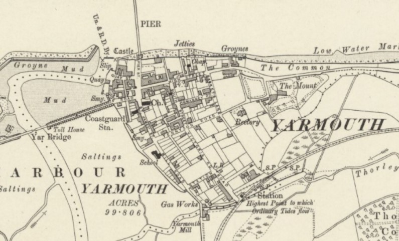
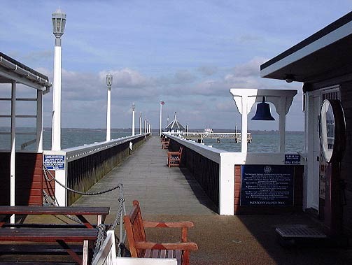
Yarmouth Pier
Opened in July 1876. A few weeks later a drifting ship damaged the new pier.
After the railway had been extended to Lymington Pier on the mainland in 1884, regular connecting services from there to Yarmouth Pier were established.
In October 1909, the barge �Shamrock� crashed broadside into the pier causing moderate damage.
In 1975, the pier became Grade 2 listed. In 1980, it needed complete restoration. Consent for demolition was refused.
In 1991, the pier-head was in a dangerous condition, and the pier repaired and re-opened in 1994. Closed in 2007, and reopened in 2008.
Yarmouth Pier map early 1900s.
Yarmouth Pier Today.
Fort Victoria Pier
Opened in 1856.
The pier was built to serve the military establishment at Fort Victoria.
In the 1930s a proposal was made to run a car ferry between Fort Victoria and Keyhaven on the mainland. An act of parliament was obtained in 1936 but a lack of funds meant the proposal was abandoned in 1938. So it was used throughout the operational life of Fort Victoria largely for military use, often just for training.
The military final left Fort Victoria in the early 1960's. The pier now stands neglected.
Fort Victoria: is a former military fort built to guard the Solent. What remains of the fort is now a Grade II Listed Building.
The earliest fort on the site was Sharpenode Bulwark (also Sharpnode or Sharpnore) which was constructed in 1545-7 as part of Henry VIII's coastal defences. It was about 700 metres east from an earlier fortification known as Worsley's Tower. Sharpenode Bulwark fell into disrepair and was repaired or even replaced in 1587 by George Carey Captain of the Island. This became known as Carey's Sconce. The defences are said to have fallen into disrepair by 1623, and at the beginning of the 19th century only ruins remained.
The current Fort Victoria was built in the 1850s and it became a military barracks and storehouse until rearmed with more modern armament in the 1880s. During the First and Second World Wars the fort saw service as a landing point and for storage. Between the wars it saw little use with the royal engineers leaving in 1920.
At the start of World War II the fort was used as a training battery for coastal gunners and it was equipped with torpedo tubes mounted on the pier. After the war it was used as a National Service training station. Its military use came to an end in 1962.
What remains today is a fragment of the fort. The rear barracks blocks were demolished in 1969 to provide material for sea defences.Fort Victoria Pier map late 1800s.
Fort Victoria Pier Today.

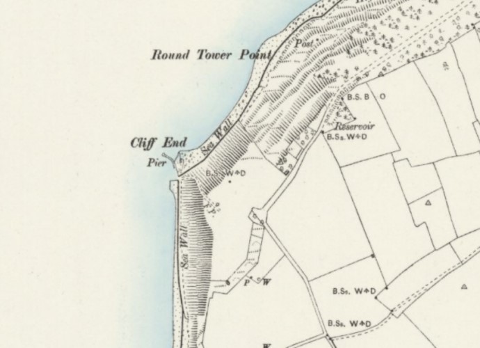
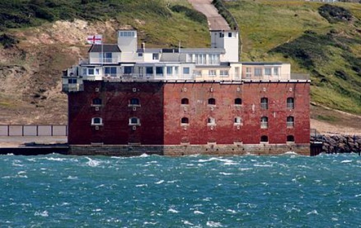
Cliff End Battery Pier
Opened in 1856. Also known as Fort Albert.
Fort Albert/Cliff End Fort: is a tower fort nestling under the cliffs south-west of Fort Victoria
It was one of the Royal Commission forts built in the 19th Century as part of Lord Palmerston's defences against the possibility of a French attack from Napoleon III. Designed to defend the Needles Passage, it was completed in 1856, after 4 years of construction, but like the American Third System forts it resembles in miniature, it would have suffered badly from rifled gunfire, so the Royal Commission enhanced it with batteries on the cliffs above. Even so, with the introduction of armoured ships, the fort became obsolete by 1858. In 1886 it was selected as one of the UK locations for the Brennan torpedo. After this, only small guns were mounted on the fort. It was closed to military use in 1957.
It has been a Grade II* Listed Building since 1994 and today is in private ownership of harbour developments and has been converted into private flats.Cliff End Battery Pier map late 1800s.
Cliff End Battery Today.
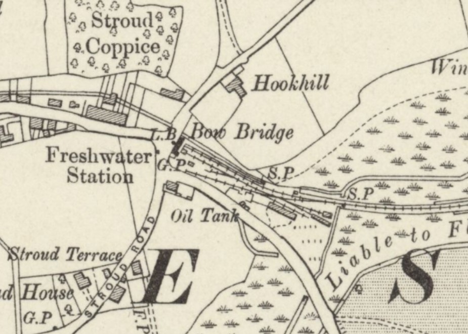
Freshwater Station (FYN)
Opened by the Freshwater, Yarmouth and Newport Railway in 1888 for freight and 1889 for passengers. Closed in 1953.
Freshwater Station was the largest on the line with a single platform and a two storey brick building. The platform was lengthened four times to accommodate longer trains and the "Tourist Train", a non-stop service from Ventnor. The station had a run round loop, two goods sidings and a cattle dock. There was also an engine shed and two carriage sheds which were demolished in 1927. After closure a book kiosk on the station was relocated in the town and is still in use. The signal box, which was relocated to Freshwater from Newport when the line was taken over by the Southern Railway, became a bus shelter and was relocated to Wootton on the Isle of Wight Steam Railway in 1987.Freshwater Station map early 1900s.
Freshwater Station 1950s.
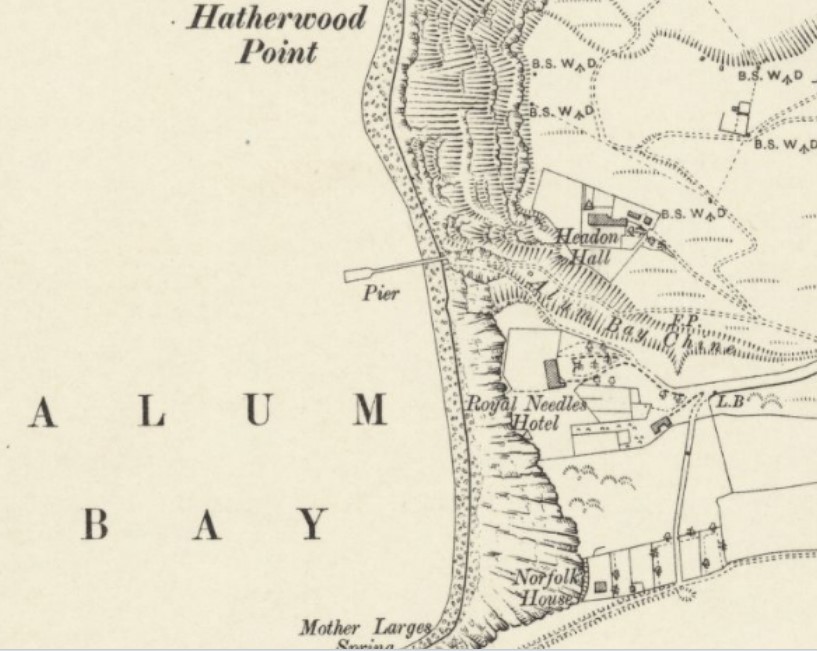
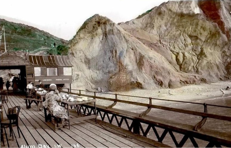
Alum Bay Pier
Two small landing stages already existed in 1862 but the first pile of the new pier was driven on 5th May 1869. The contractor for this wooden structure was J.White of Cowes. A 370 foot iron replacement opened on 5th August 1887 and, for a while, steamers called regularly on their way to Southampton, Bournemouth, Portsmouth, and other resorts on the island. However, steamer traffic became infrequent after the First World War.
The pier was declared unsafe in 1925 and closed. A span collapsed during a severe storm in the winter of 1927 and was never replaced. It remained until the late 1950s, but there is now no trace. A �mini-pier� (a walkway on concrete piles to a floating pontoon built in the late 1980s) caters for passenger launches taking trippers to the Needles headland.Alum Bay Pier map late 1800s.
Alum Bay Pier late 1800s.
Alum Bay Pier early 1900s.
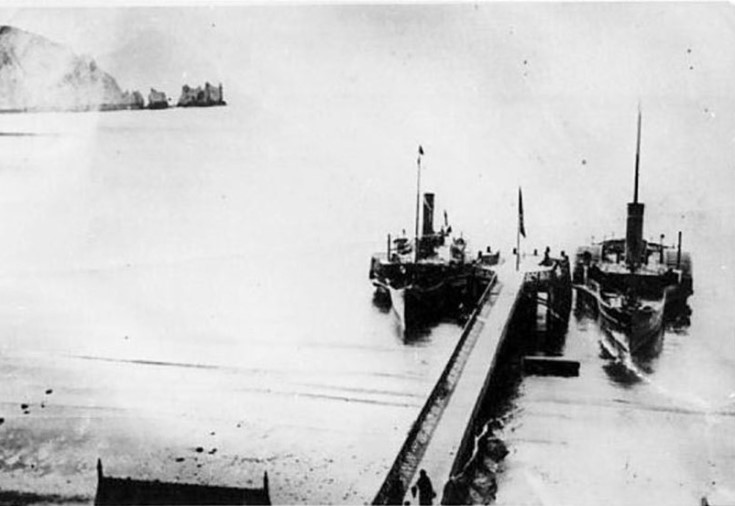
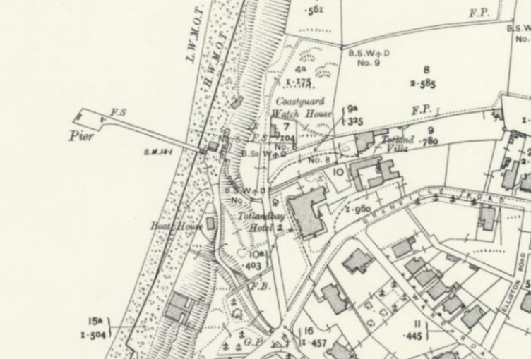
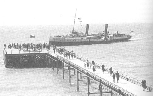
Totland Bay Pier
Opened in 1880
The Totland Bay Pier Provisional Order was advertised in March 1879 to replace the ruinous old wooden structure. The 450 foot pier was completed the following March to a design by S.H. and S.W.Yockney. It opened that summer and facilities included a pier-head shelter and a tiny shoreward end amusement pavilion. Boats also called.
At the end of the 1927 summer season the ferry service ceased, though pleasure cruises continued until 1931. The pier was sectioned during World War II as a defence measure but was repaired by consultant engineer, Mr R.Humby of Poole. The pier re-opened on 17th June 1951 and received its first steamer for twenty years (the �Lorna Doone�). The official re-opening took place in 1952. A new pier-head shelter was constructed in the 1950s.
Between then 1975 and 1992, the increasingly dilapidated pier changed owners several times. The amusement arcade was damaged by fire in August 1978 and, following a safety inspection, the pier was closed. It suffered storm damage in October 1987.
In 1999, the pier was bought by Mr Derek Barran, an artist who used the main building on the pier-head as a studio. The pier was sold in 2012. It is amticipated to re-open in 2021.Totland Bay Pier map early 1900s.
Totland Bay Pier 1951.
References:
RRA
Wikipedia - Ryde and Victoria Piers
Wikipedia - Isle of Wight Railways
Wikipedia - Isle of Wight Railway Company
Isle of Wight Steam Railway
Disused Stations - Isle of Wight
The J.W. Sutherland collection
Wikipedia - Isle of Wight Pier
Wightpedia
National Piers Society
National Piers Society
IslandEye - Isle of Wight Pier
Wikipedia - Ryde Pier Head Railway Station
Wikipedia - Ryde Esplanade Railway Station
Wikipedia - Ryde St John's Road Railway Station
Ryde St John's Road Shed
Wikipedia - Smallbrook Junction Railway Station
Islandeye St Helens Station
Islandeye St Helens floating railway
Bembridge and St Helens Harbour Association
Bembridge Harbour Trust
Islandeye - Bembridge Airport
Wikipedia - Brading Railway Station
Wikipedia - Sandown Railway Station
Wikipedia - Lake Railway Station
Wikipedia - Shanklin Railway Station
Islandeye Shanklin Pier
Islandeye Ventnor Pier
Wikipedia - Newport Railway Station
Wikipedia - Wootton Railway Station
Wikipedia - Fort Victoria
Isle of Wight Aviation
Hampshire Airfields - IOW
Wikipedia - Saunders-Roe Princess
Gift To Nature
Wikipedia - J. Samuel White
Cowes Giant Cantilever Crane
Old Maps Online
